How can online and distance learning be organized in times of digital (university) teaching? In a GDM article, the MathCityMap team presented MCM@home as an idea for teaching mathematics during the corona pandemic.
What is MCM@home about?
As usual, MCM@home uses the two components of MathCityMap – the web portal and the app. While teachers create tasks in the web portal, students can edit them with the help of the MCM app. In doing so, they receive hints, feedback on the task and insight into a prepared sample solution. So far as usual.
But the task formats differ, of course: Now the tasks are no longer worked on on site at an interesting object outdoors, but solved from home. Consequently, all necessary information is provided in the task – or can be counted, estimated or measured on the basis of the task picture.
Why should I use MCM@home?
Many students complained about a (perceived) lack of personal feedback from the teachers during the corona lockdown. At the same time the teachers noticed that the technical equipment and the handling of technology are high barriers for the Distance Leanring. Both problems are addressed by MCM@home:
When using the Digital Classroom, teachers can view the progress of their students in real time (e-portfolio) and provide targeted feedback via chat. Of course, students can also use the chat to ask for specific help (see picture). Thus, MCM@home offers the possibility of synchronous online teaching.
Since only a smartphone is needed for MCM@home and almost all learners know how to use modern cell phones safely, technical barriers and problems are not to be expected.
Do MCM@home trails already exist?
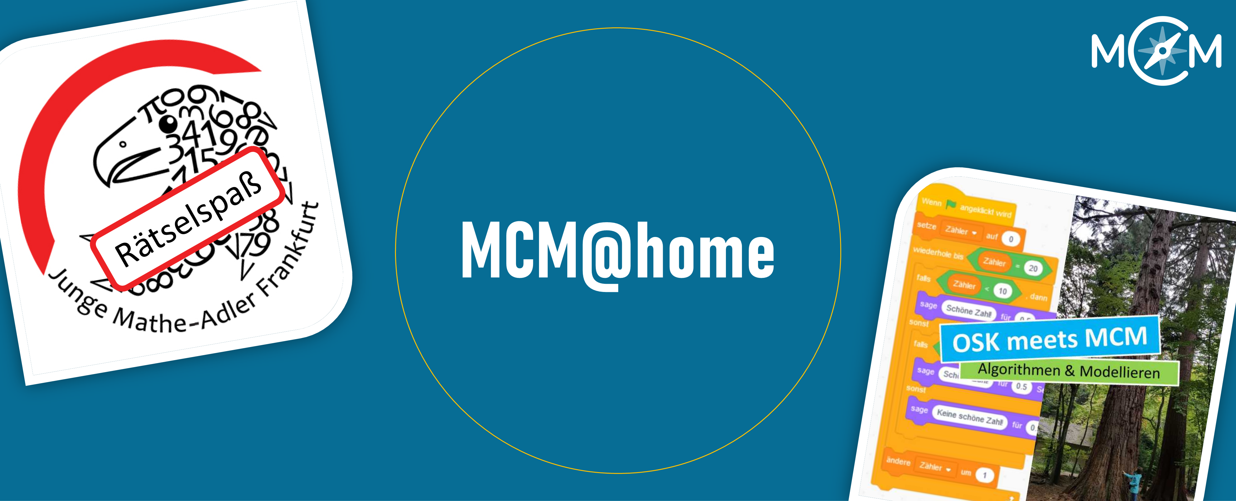
We already presented a whole series of MCM@home trails in spring. You can find them here. Two examples of MCM@home-trails we would like to briefly outline here:
- Mathe-Adler Riddles (code: 282593) for students of the 3rd & 4th grade: The trail was created for the youngest learning group of the Mathematical Gifted Young Math Eagles Frankfurt under the direction of our MCM-educator Simone Jablonski.
- OSK meets MCM: Algorithms & Modeling (code: 343258) for teacher students on upper secondary level: In the course “Didactics of Upper Secondary Courses”, which is supervised by Gregor Milicic and Simon Barlovits from the MCM team, students will develop their own MCM@home trails. The trails should contain both mathematical and didactical questions. We have already prepared an example trail on Algorithms & Modeling.