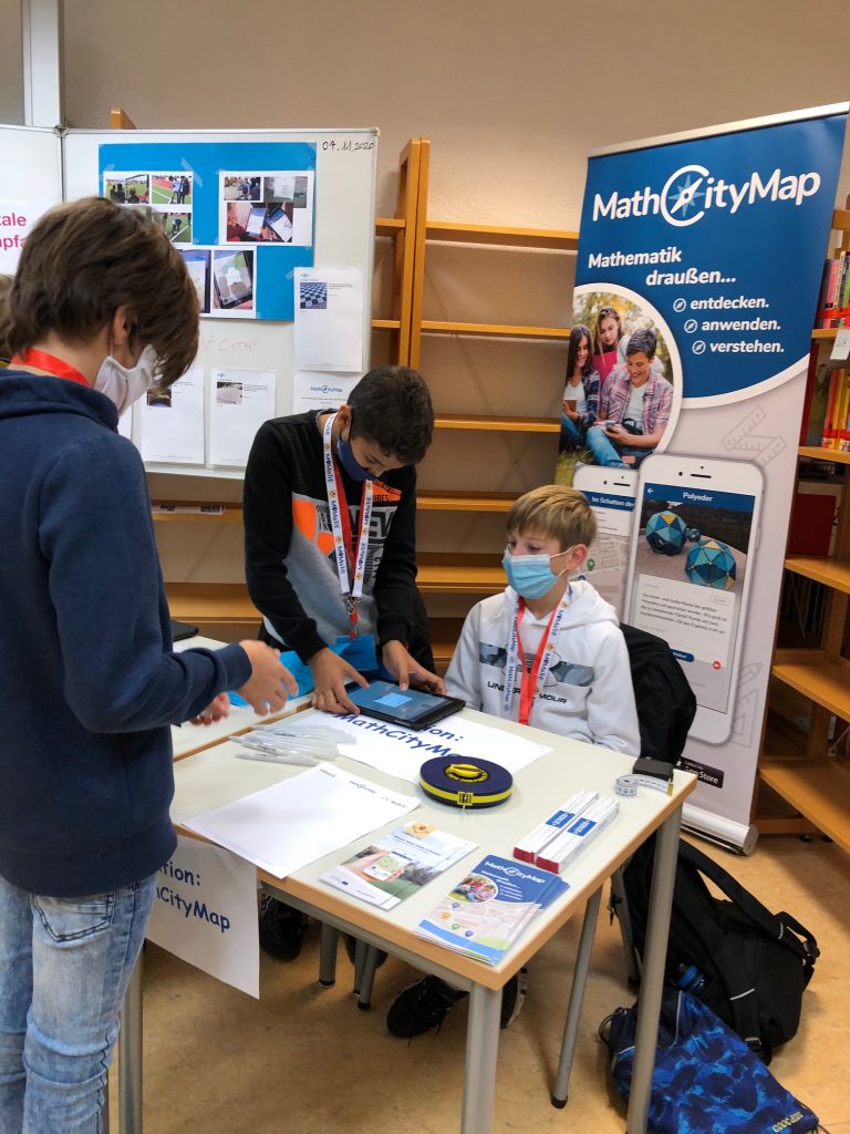
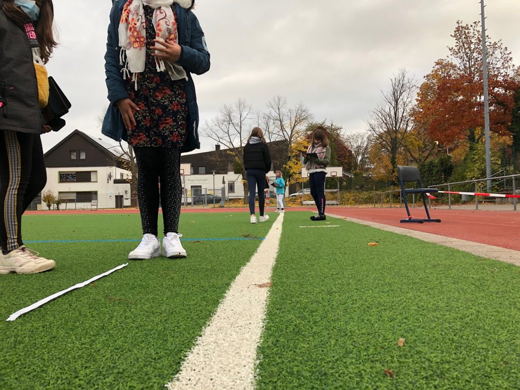
Ceren Kaya has created the 19,000 task on the MathCityMap Web Portal! As part of the seminar “New Media in Mathematics Education” at Frankfurt Goethe University, the use of MathCityMap in the classroom is of course also discussed.

For this purpose, the student teachers get to know the MathCityMap system from the learner’s point of view and work on a math trail of their choice. In addition, the use of our tool Digital Classroom is reflected upon (teachers’ perspective).

From the author’s perspective, the students create their own assignments. For this purpose, a picture of the monument of the Hassia spring in Bad Vilbel as well as the corresponding dimensions of the base were given. The student teacher Ceren Kaya then created the task “Mathematics with a magic hand”, in which the volume of the base is to be calculated.

We look forward to many more tasks on MathCityMap!

Dear users,

MathCityMap as a participatory project thrives on you using the existing tasks & mathtrails and creating your own tasks & trails. Today we would like to present you some numbers from the MathCityMap statistics:

  • A total of 18,600 tasks have been published on the MathCityMap web portal since mid-2016 – of which nearly 6,000 were published in 2020. Of these, approximately 7,000 tasks were published.
  • 2100 new users have registered with MathCityMap in 2020. In total, the MCM community now counts 6,400 members.
  • The most downloaded mathtrails war 2020 the trail “Forum 2020” by Christian Mercat in Marseille and the trail “[EN] Berlin Gendarmenmarkt” by Simone Jablonski. The MCM@home trail “Campo de fútbol del Racing de Santander” by Claudia Lazaro won the third place.
  • In total, our more than 60 MCM@home trails for distance learning in the Corona pandemic have been downloaded more than 1500 times. Fantastic!

We are already looking forward to welcoming many new members to the MCM community in 2021 and discovering new, exciting tasks all over the world.

Your MathCityMap Team Frankfurt

Dear users,

Another year is drawing to a close (this time probably a very turbulent one for all of us). Christmas is just around the corner. Time for us to take a brief look back at the past year:

  • This year, almost 5,500 new tasks were created in the system, so that we now count a total of almost 17,600 tasks in the MathCityMap portal, of which about 7,000 tasks were published.
    We also saw a sharp increase in registered users: Approximately 2000 new MathCityMap users registered in the system. In total, the MCM community now counts 6,200 members.
  • Our Erasmus+ project MoMaTrE (Mobile Math Trails in Europe) was successfully completed. We would like to thank our European partners from Lyon (France), Porto & Lisbon (Portugal), Santander (Spain) and Nitra (Slovakia) as well as our app developer team from autentek in Berlin for the great collaboration over the past three years. At the end of the project, the ROSETA proceedings all about extracurricular learning with digital media in science and technology subjects was published – of course, the focus here was also on our MCM system.
  • In May we were able to present our new MathCityMap web portal: In the new design, creating tasks & trails is even more fun – especially since there are now also awards for working with MathCityMap: For creating tasks & trails, running digital classrooms, downloads of your own trails or your contact to other MCM users, you can collect up to six badges each.
  • To make running MCM trails even more fun, we’ve also given our app a new design. In addition to the visual redesign, the app now offers the option to create tasks and trails directly on your phone.
  • To support virtual teaching and distance learning, we developed the MCM@home concept: due to the pandemic, the idea here was to solve tasks from home rather than on site. In total, more than 60 MCM@home trails were created worldwide, which were downloaded more than 1500 times. Fantastic!

Not only because of the Corona pandemic, but also caused by the presented further developments of our MCM system, the past year was exciting for us. However, the great development of the user numbers and tasks would not have been possible without your help and use of the platform. And so, despite all the changes, MathCityMap remains what it is: a digital system for school practice.

We wish you and your families a Merry Christmas and a Happy New Year 2021. We are already looking forward to welcoming many new members to the MCM community and discovering new, exciting tasks all over the world. Stay healthy!

Your MathCityMap Team Frankfurt

The math teacher Fabienne Nykiel created the trail “A math trail for Markdorf!” together with her students. In the following, the teacher explains how the students of class 7c of the Markdorf educational center worked out the tasks.


How did finding & creating the tasks work with your class? Describe the process from the first idea to the finished trail.

A group of students designed a modeling task on triangular construction together with me in the centre of Markdorf. The teacher informed herself in advance which location might be suitable for a potential modeling task on a specific topic and led the group to this location.

At this location the modeling cycle was discussed again with the students in a didactically reduced form and it was then explained that this cycle is now run backwards (I have called this process of modeling “extended modeling”): In a single work phase the students explored the local situation and each of them thought about the potential possibilities of this location alone in order to design a possible modeling task for the specific topic. After this phase, each student presented his/her ideas. In the plenary session, the students used this as a basis for discussing and debating which idea was the most suitable, creative, individual and closest to reality, whereby several ideas could also be combined into one (‘Think-Pair-Share-Method’).

After the students had already had their goal and result in mind, they considered how they could achieve this goal in the world of mathematics, i.e. by mathematical work (estimating, measuring, calculating, constructing, …) and carried out their considerations simultaneously. In doing so, they filtered out the explicit hints that could later be given in the MathCityMap app. Each small group was fully motivated and enthusiastic. They all emphasized that it was a lot of fun to finally do something ‘useful’ with mathematics.

As a last step, the students formulated the task, the three hints and the final solution (with its range of solutions) in detail. I transferred this information to the web portal and created the individual tasks. At the end, all tasks were combined into a trail. As a project conclusion, the trail was run and worked through together on a school day. As far as the Corona regulation (again) allows it, the parallel classes also want to go through the trail.


What do you see as the advantages if the learners create the tasks themselves? What do you hope to achieve?

A big advantage that I have seen in this project was the improvement of the modeling competence of SuS, which has especially developed through “Advanced Modeling”. In addition, SuS also deals with the trained content competencies from a different perspective. Social skills are also trained, such as the ability to work in a team.

Therefore, I hope that I will not only be able to better train the modeling skills, but also a sustainability of the teaching content. I hope that SuS will not forget these mathematical contents and also the modeling skills.

A further advantage is the strengthening of the personality of SuS. They were all visibly proud of the fact that they designed the math trail themselves. The joy was even greater when they learned that the trail would be published and was nominated for the Math Trail of the Month.


Is there a task that you particularly like? If so, please describe it.

I think the task “A larger church clock for Markdorf” is very successful, because many skills are trained. On the one hand, it must be estimated that the gable is an equilateral triangle, whereupon the SuS must measure the width of the tower, which gives them the length of each side of the triangle.  Only with this information can the SuS design the triangle on a sheet with a suitable scale and determine the center of the inscribed circle.

What I particularly like about this task is that it seems ‘unsolvable’ at first glance, because the gable is so far away and cannot be measured easily.

Melanie Schubert from Goethe University Frankfurt has created the task “The Dinosaur’s Suitcase” and reports in an interview about her experiences with MathCityMap.


Dear Melanie, how did you get to know MathCityMap project? How do you use MCM?

I got to know MCM while working at the Goethe University Frankfurt, where the system is developed. As part of our mathematical gifted students promotion program “Junge Mathe-Adler Frankfurt” I created the trail “Mathe-Adler Klasse 6” for SuS of the sixth grade as a kick-off event.

Describe your task. How can it be solved?

In my task the volume in liters of an oversized suitcase is to be determined. In front of the Senkenberg Museum in Frankfurt there is a large dinosaur figure with a suitcase standing in front of it. Within the task the SuS receive information about human suitcase sizes, if one would go on vacation for about 2 weeks. The SuS can calculate the volume of the suitcase by approximating the suitcase of the dinosaur as a cuboid and then convert the volume into dm³ to determine the number of liters. By specifying the liter sizes of our suitcases, the SuS have a possibility of self-control, in that the SuS can consider whether about 27 of our suitcases can fit into the suitcase of the dinosaur.

What didactic goals do you pursue through these tasks?

This task is intended to expand the spatial imagination, conversion skills, measuring skills and the competence of modeling.

Melis Yaren, mathematics teacher at the Carl-Zuckmayer Realschule in Nierstein, organized a “math day” for and with her 6th grade. At different stations, new perspectives on mathematics were opened up – MathCityMap was of course also used. Below Melis Yaren reports on the “Maths Day”.


What is the math day about? What did the students do here?

I organized a math day with my class 6b (only in the class association because of Corona). There were a total of 5 different math stations and in each station different math problems. The goal is that I offer the students different perspectives on math based on these stations. At the 1st station “MathCityMap” the students presented the tasks/route of MCM, which we had solved in the math class before in the schoolyard. In the math day they also found new tasks for the app in the school grounds. At the 2nd station “Learning math digitally” the students presented the digital apps and web tools that we have learned and practiced so far with the tablets in math class. At the 3rd station “Learning math playfully” we had math games, tangram, geo boards, dice and wheel of fortune experiments. At station no. 4 they solved and presented Fermi tasks. At the 5th station “Guessing” they prepared guessing tasks (with smarties, beans, chocolate sweets, etc.) for their classmates and teachers. 

How was MathCityMap used for this?

The students of 6b solved the tasks in the math class outside and later presented them in the math day (on 10.11). The route “Carl Zuckmayer Realschule Plus” was published last year – I created it for my project group (click here for the report). The tasks “barbecue hut” and “sports field” were best suited for the kids.

How was the feedback of your students on the math day and especially on MathCityMap?

The students definitely enjoyed experiencing math on the math day from a different perspective. Especially the app MCM!! The suggestion came from the students: they wanted to find new tasks for MCM on school grounds, discover them themselves and create them digitally. Now you ask in every math lesson if we can go out and do math outside 🙂 

Today we would like to introduce our new PDF trail guide, which can be used as a paper version in addition to the smartphone app: As usual, you will find the trail guide in the menu bar under the title picture of your chosen math trail. By clicking on the PDF symbol you have three options: Select the “Worksheet” option to download the new trail guide. There you will also find the standard version for the learners and the accompanying PDF for teachers.

In contrast to the standard version, the students receive a checkered paper for calculating. There is also space for entering the measurement results and a result field.


We wish you a lot of fun with the new PDF Trail Guide!

How can online and distance learning be organized in times of digital (university) teaching? In a GDM article, the MathCityMap team presented MCM@home as an idea for teaching mathematics during the corona pandemic.


What is MCM@home about?

As usual, MCM@home uses the two components of MathCityMap – the web portal and the app. While teachers create tasks in the web portal, students can edit them with the help of the MCM app. In doing so, they receive hints, feedback on the task and insight into a prepared sample solution. So far as usual.

But the task formats differ, of course: Now the tasks are no longer worked on on site at an interesting object outdoors, but solved from home. Consequently, all necessary information is provided in the task – or can be counted, estimated or measured on the basis of the task picture.

Why should I use MCM@home?

Many students complained about a (perceived) lack of personal feedback from the teachers during the corona lockdown. At the same time the teachers noticed that the technical equipment and the handling of technology are high barriers for the Distance Leanring. Both problems are addressed by MCM@home:

When using the Digital Classroom, teachers can view the progress of their students in real time (e-portfolio) and provide targeted feedback via chat. Of course, students can also use the chat to ask for specific help (see picture). Thus, MCM@home offers the possibility of synchronous online teaching.
Since only a smartphone is needed for MCM@home and almost all learners know how to use modern cell phones safely, technical barriers and problems are not to be expected.

Do MCM@home trails already exist?

We already presented a whole series of MCM@home trails in spring. You can find them here. Two examples of MCM@home-trails we would like to briefly outline here:

  • Mathe-Adler Riddles (code: 282593) for students of the 3rd & 4th grade: The trail was created for the youngest learning group of the Mathematical Gifted Young Math Eagles Frankfurt under the direction of our MCM-educator Simone Jablonski.
  • OSK meets MCM: Algorithms & Modeling (code: 343258) for teacher students on upper secondary level: In the course “Didactics of Upper Secondary Courses”, which is supervised by Gregor Milicic and Simon Barlovits from the MCM team, students will develop their own MCM@home trails. The trails should contain both mathematical and didactical questions. We have already prepared an example trail on Algorithms & Modeling.

In the past weeks we presented on our website a variety of math trails, which were created during our award-winning MathCityMap seminar at the Goethe University Frankfurt. All of these trails have been tested by students on site and have also passed our expert review. Lastly, in this section we presented the trail “The Sinai Park” by Isabella Unkart.

At the end of this section we will choose the math trail by Jens-Peter Reusswig as the Trail of the Month October. The trail offers not only a variety of mathematical discovery possibilities, but also allows for interdisciplinary lessons: All tasks of the trail “The Thick Fir” have references to ecology: By working on this trail, the students not only learn mathematical content, but are also sensitized to biological facts and topics. Below, part 1 of our interview with Jens-Peter Reusswig is presented.


How did you find out about the MathCityMap project? Did you get to know and use MCM before the Mathtrail seminar?

I learned about the MathCityMap project for the first time in the mathematics-didactic advanced seminar “Teaching ideas in Sek I & II under the aspects of analysis” by Mrs. Schubert in the last semester. The app was introduced to us by a course participant and we could then walk a short path ourselves. At that time I only knew the app from the user’s point of view, but not from the perspective of a MathCityMap author.

Describe briefly the main content of the seminar.

The main content of the seminar was to understand the idea behind MCM, to get to know the web and app application and finally to develop a trail step by step by myself. The beginning therefore consisted of the development of theoretical basics to know where MCM has its origin and to be able to estimate the potential of extracurricular learning places. Afterwards the seminar gradually became more practice-oriented and we got to know MCM not only from the student’s perspective but also from the author’s perspective.

The team of experts had a lot to come up with, so that the digital exchange sometimes consisted of a podcast, a video message or a forum discussion.

In the seminar I learned …
1. Which criteria an MCM task must fulfill and which task variations can result from it on the different levels of understanding of terms according to Vollrath.
2. that it is not bad if a task sometimes goes through several revision circles.
3. it is worthwhile to use the task wizard from time to time.
4. you simply have to edit a trail yourself to know what is important.
5. MCM is leaded by an experienced team who put their heart and soul into the further development of the app and the portal.

Describe your trail in a few words.

The trail near Freigericht / Somborn leads along the forest nature trail to the clubhouse to the “Thick Fir” of the Schutzgemeinschaft Deutscher Wald on the Spessartbogen hiking trail. On the round way one is to guest in a miracle of nature. The forest is a place of recreation, carbon dioxide storage and economic area at the same time, but above all it is a boundless classroom.

The trail runs through this versatile learning location, combining mathematical challenges with ecological background knowledge to create a very special learning experience – inside and outside the app. This not only trains mathematical skills, but also promotes knowledge about the forest and its inhabitants.

Why did you decide to do a trail with a focus on ecology?

I chose to focus on ecology because I was looking for an extracurricular place of learning that is familiar to many learners and contains meaningful questions that can be answered with mathematical tools.

With the forest ecosystem I had found a suitable environment that also encourages discovery, amazes students and can be experienced with all senses. The trail also integrates the local learning offer, which has always informed walkers about the forest as a habitat and explains why it is so worth protecting.

How does this fit in with interdisciplinary learning?

Interdisciplinary learning aims at showing connections, in this case connections between maths and biology. It is important to make it clear to learners that ecological issues cannot be solved without mathematics, and at the same time, that without ecology, mathematics would lose an important field of application with pressing future questions. By linking the two disciplines, mathematical tasks are suddenly linked to the reality of life and anchored in an authentic application context.

For which grade levels is the trail intended?

Since the trail requires a good reading comprehension and often several solution steps are necessary, it is recommended that students in grades 9 and above work through the trail independently. However, if groups of learners explore the tasks in groups, it is possible to work through the trail earlier.

The Junge Mathe-Adler [engl.: Young Math Eagles] fly again! Our mathematical scholarship for gifted students from Frankfurt and the surrounding area under the lead of Simone Jablonski, Melanie Schubert and Steffen Burk started the new season with a highlight: Working on a math trail with MathCityMap!

Our new third graders as well as the students of the sixth grade worked on the tasks alongside their parents with great commitment and solved many a tricky mathematical problem. Here you can find the completed trails:

We are already looking forward to the upcoming sessions of the Mathe-Adler, which will be digitally completed in MCM@home format due to the current situations. Have fun & success!