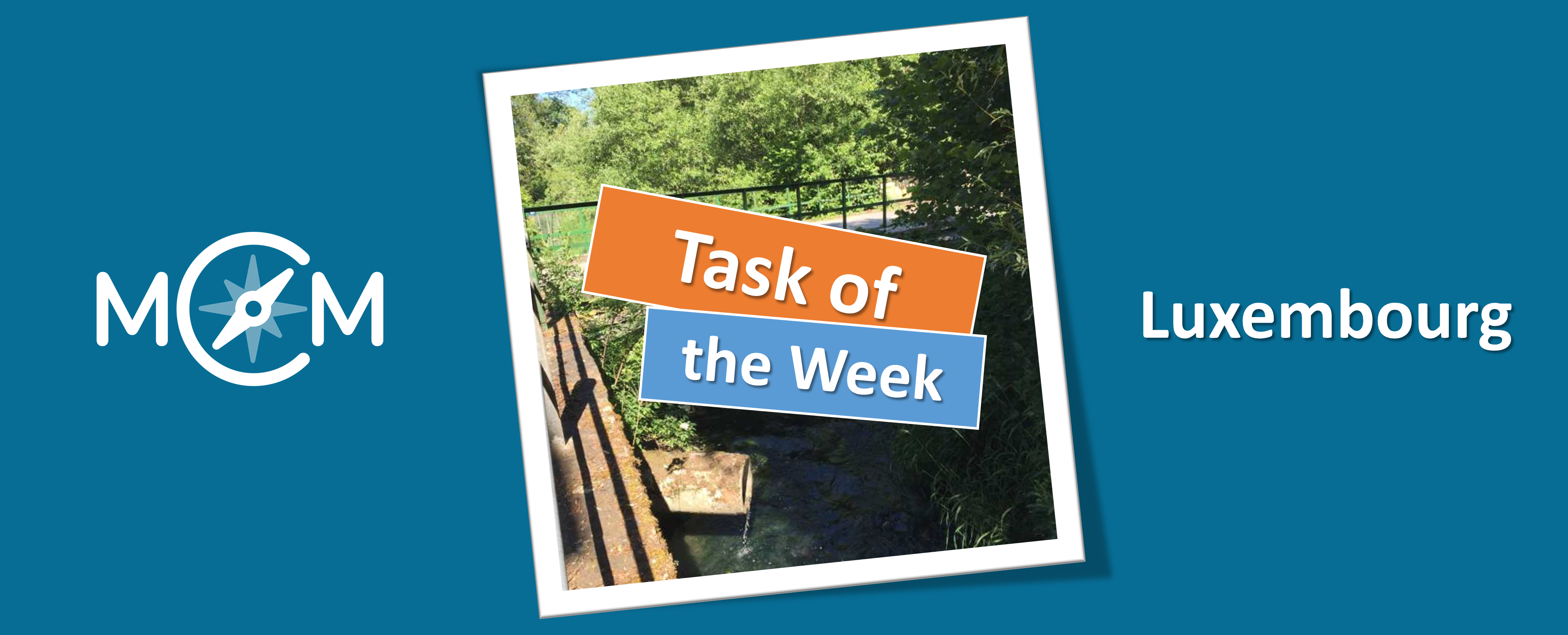
The student teacher Jill Groos created the task “Ahoy sailors!” in Stadtbredimus, Luxembourg, which we present today as the new Task of the Week. In our interview Jill Groos explains how the task can be solved and gives us insights into her teacher training.
How did you get to know MathCityMap?
I am a student at the University of Luxembourg in the Bachelor of Teacher Education. The MathCityMap project was presented to me by our professors at the university. In this summer semester, in the subject “Didactics of Mathematics”, our semester project was to design a math trail with MathCityMap.
Please describe your task. How could you solve it?
My task is about first and second graders building a paper boat. Then the boat is let into the water on one side of the bridge and students are asked to count how long the boat takes to come out on the other side of the bridge. The task is solved by counting, to be more precisely by counting seconds.
Which didactic goals do you want to promote with this task?
The children should take a closer look at the familiar tower and recognise that they can find numbers everywhere, even “in real life”. In our daily life we are surrounded by numbers!
Do you have any further comments on MathCityMap?
The didactic goals of this task are in the areas of learning to count, problem solving and learning to tell time. It is important that the children can work out a solution for an existing problem, learn how to count seconds and learn to count in total.
This morning the Community Website was released as a new part of the MCM web portal. As an output of our Erasmus+ project MoMaTrE, the community website aims to connect MathCityMap users all over the world. MathCityMap now has its own small social network.
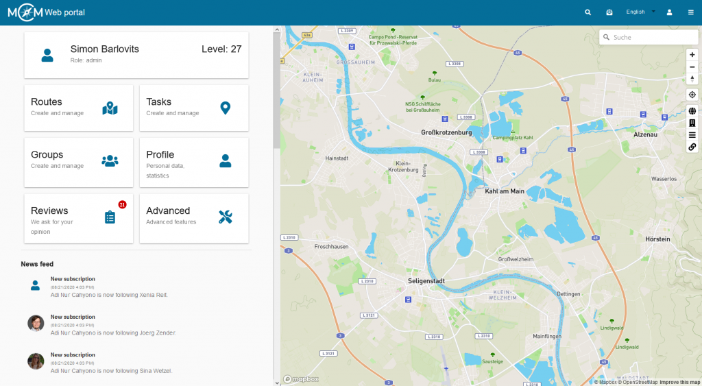
With the launch of the MCM community website, it is now possible to follow other users and write posts. In addition, you can celebrate your own successes in the MCM portal by winning awards and show them to others. The first changes are already noticeable when you enter the MCM web portal: at the top of the toolbar there is now a small letter, which may already be marked with a red number to announce the existence of new notifications. These notifications inform about new followers, news, contact requests and of course about new awards.
The feed is waiting under the main menu on the start page of the MCM web portal. The first time you log in to the MCM web portal since the community website was published, this feed is empty. However, it will fill up quickly as soon as you follow other MCM users. From then on, the feed informs about the latest activities of the users you are following. Who last published a new trail or task and who is collecting awards? In the feed you can find all this information bundled together.
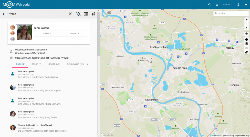
The Community Website offers much more than that which is visible on the start page. The menu item “Profile” takes you to your own personal page, which is still quite empty at the start of the Community Website and which needs to be filled in. In addition to uploading a profile picture, you can enter information about your activity and job here, as well as link to your own website, if available. The timeline, located directly below the profile, provides an overview of your own activities.
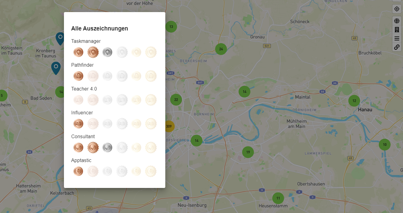
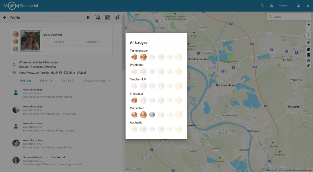
One of the most interesting innovations is certainly the numerous awards that can be received. At the launch of the community website there are awards for achievements in six different areas: Number of published MCM tasks, number of published MCM trails, number of reviews completed, number of digital classrooms completed (with a minimum of four participants and a minimum duration of 45 minutes), number of followers and total number of downloads of own trails in the MCM app. For each of these awards there are six levels to achieve. Those who can adorn themselves with a silver award (level 3) have already gained a lot of experience in using MathCityMap. To reach the last level, a golden award, decorated with a wreath, even professionals have to make an effort. A click on the award symbol in the toolbar of your profile gives information about the required numbers for the different awards.
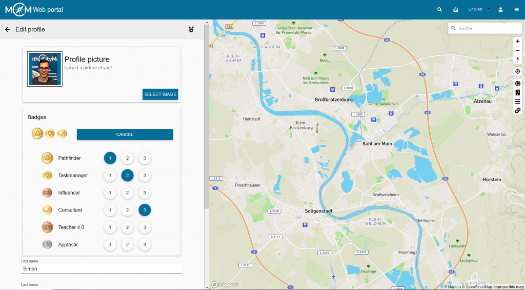
In your own short profile, which from now on can also be seen in the self-created tasks and trails, up to three awards can be displayed and thus made visible to everyone at first glance. The selection of the awards that are displayed can be made in the profile’s edit mode.
There are several ways to interact with other users. For example, you can use the small magnifying glass in the toolbar at the top of the portal to search for a user whose name you know. On the profile of another user you now have various possibilities for interaction, some of which are only activated when you follow the person. For example, you can write a message to others or request their contact information if you want to exchange information outside the portal.
We hope you enjoy exploring the community website and following each other, writing messages and of course collecting awards!
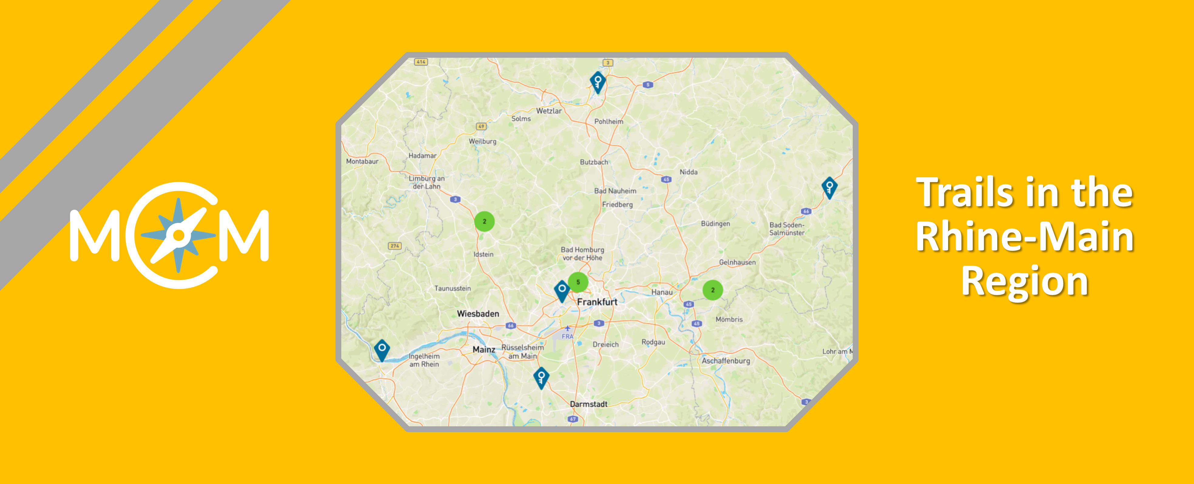
The seminar “Mathtrails – Digitalization of Outdoor Mathematics Education” of the Goethe University Frankfurt was awarded as one of 13 projects by the MINTchallenge of the Stifterverband for excellent digital teaching during the Corona pandemic. In the seminar, our MCM educators Iwan Gurjanow and Simon Barlovits presented the MathCityMap system to student teachers. Currently, we present the math trails which were created during the seminar in the section “Tested Trails in the Rhine-Main Region”.
With the MINTchallenge under the motto “Studying from a distance”, the Stifterverband’s MINT Club “presents digital teaching and learning formats that enable students to continue their MINT studies during the corona pandemic, and in the long term will be an enriching addition to the MINT studies. With more than 150 candidatures, the Club-MINT-Challenge has met with a great response and shows that the MINT study programmes have mastered the digital semester with creative and innovative ideas”. Click here for the presentation of the thirteen award winners by the Stifterverband.
We are very pleased that our Mathtrail seminar was awarded by the Stifterverband!
In the German town of Schwalbach, our student Daniel Tiedke has created the math trail “Einstein Trail”. The trail was created during our Mathtrail seminar at the Goethe University Frankfurt. All trails were tested by students on site and also passed our expert review. Recently we presented the trail “Großauheimer Altstadt” by Martina Kranz in our section “Tested Trails in the Rhine-Main Region”.
Information about the trail: Name: Einstein Trail Code: 362923 Place: Schwalbach Grade: 5th/6th grade Subject: area & volume
The trail is located oon the schoolyard of the school Albert-Einstein-Gymnasium and is therefore easily useable for all classes of the school. Within this trail, the students should discover well-known objects from a mathematical perspective.
The next trail in our section “Tested Trails in the Rhine-Main Region” is located in the Hanau quarter of Großauheim. There, our student Martina Kranz has created the math trail “Großauheimer Altstadt”. The trail was created as part of our mathtrail seminar at the Goethe University in Frankfurt. All trails were tested by students on site and also passed our expert review. Recently, we presented the trail “Stadt Schlüchtern 7/8” by Johanna Walter in this section.
Information about the trail: Name: Großauheimer Altstadt Code: 142900 Place: Hanau-Großauheim Grade: 6./7. Klasse
The trail leads through the beautiful old town of the Hanau district Großauheim. In small groups the pupils can solve mathematical problems around the Alte Langgasse. The trail ” Großauheimer Altstadt” deals with mathematical topics of 5th and 6th grade. Therefore, the trail can be used at the end of the sixth grade or at the beginning of the seventh grade to recall topics from the last years. The tasks of the trail range from simple combinatorics and fractions to geometry.
The task is: How far is the distance from Großkrotzenburg to the city centre of Hanau? Calculate! Enter your result in cm. The learners can read the required information on a signpost. The real challenge is then to convert the 4km + 4.5km = 8.5km into centimetres.
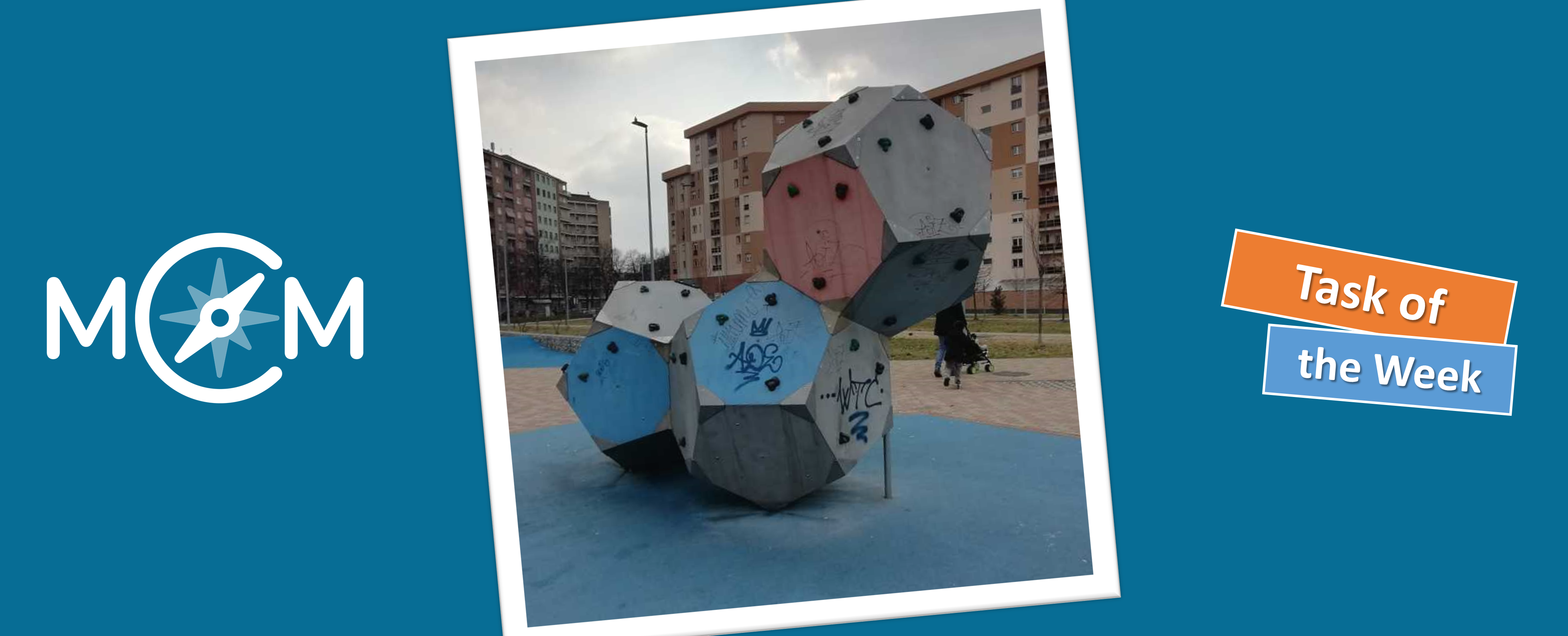
In Turin, Italy, we find our new task of the week. Here the teacher Michela Viale created the task “I blocchi da arrampicata del Parco Mennea” (engl.: “The climbing blocks of the Mennea Park”), in which the visible surface of stapled dodecahedrons should be calculated.
Michela, how did you discover the MathCityMap project?
I got in contact with MCM four years ago, when I was attending a math online course at the university of Torino, Math Department, where I had to create my first MathCityMap task. By participating another MOOC in the spring of 2020, I created my own math trail on MCM.
I am a teacher at middle school (from 11 to 14 years old) and I love to create “real problems” for my students. By using MCM I can organize outdoor mathematical problem solving for my students.
Describe your task. How can it be solved?
My task is placed in a park in Turin (Parco P. P. Mennea). It is a climbing block for children made up of three dodecahedra. Since the blocks are stapled on top of each other, they have some common sides, which are therefore not visible. I ask to children to calculate the area of the visible sides (the surface they could paint). They have to recognize the dodecahedron, count the number of the sides they could paint, calculate the area of one side (which is a regular pentagon).
What didactic goals do you pursue with the task?
I want to stimulate different didactic aims: recognize solids and plane figures around us, measure them, calculate their surface. In general, I think MCM is very useful to improve Math competences. I’ll create a new math trail during my holidays in Sardinia in August.
In the German town of Schlüchtern, our student Johanna Walter has created the math trail “Stadt Schlüchtern 7/8”. The trail was created during our Mathtrail seminar at the Goethe University Frankfurt. All trails were tested by students on site and also passed our expert review. Recently we presented the trail “Mathtrail along the Rhine” by Alysha Kremmelbein in our section “Tested Trails in the Rhine-Main Region”.
Information about the trail: Name: Stadt Schlüchtern 7/8 Code: 242888 Place: Schlüchtern Grade: 7th/ 8th grade Subject: Stochastics, Geometry, Analysis
The trail is located in the town centre of Schlüchtern and is therefore easily accessible from the schools. Divided into small groups, the pupils walk from the little castle to the old people’s home. Afterwards they continue their walk in the direction of the synagogue. On the way to the Mauerwiese, the pupils make a stopover at the Protestant church. You will find two more tasks at the Ulrich-von-Hutten Gymnasium.
Whether it is the yearly swimming after passing the school-leaving exams at the U-v-H or the building of the synagogue, the tasks deal with everyday objects and situations. In this way the pupils learn how much maths can be found in the small town of Schlüchtern, if you just look carefully.
The math trail can be used as a repetition of the topics from Classes 7 and 8, as tasks on stochastics, analysis or even geometry are part of the trail. In addition to their smartphones, the children need a measuring tape and a calculator to work on the trail.
Exemplifying task:This is difficult! “How many tons must a vehicle be allowed to transport to deliver all the stones of the stairs at once? One m³ stone weighs 2300 kg.” Here the students first have to calculate the volume of the stones. To do this, they must know the formula for calculating the volume and measure the required values exactly. In the second step they have to convert the unit. If difficulties arise, the hints will help them to solve the task.
On July 20, Sanne Kleinhenz, a German student at the Rhön-Gymnasium in Bad Neustadt, created the 15,000 task on the MathCityMap web portal. After the summer holidays, Sanne and her class mates will publish three new trails in Bad Neustadt. We are looking forward to it! In the following interview, Sanne Kleinhenz explains how MCM is used in her school.
Dear Sanne, how did you get to know MathCityMap? How do you use MCM at school?
I am a student at Rhön-Gymnasium and we work with MathCityMap in the P-Seminar. The project seminar in Bavaria is designed to prepare upper school students for their choice of studies and profession. The P-Seminar is generally about learning to work independently and in groups. We (14 students) have chosen the P-Seminar with the name MathCityMap (leading subject mathematics). First we got familiar with the app and website by creating a small trail through our school building together.
Divided into three groups we created tasks at different locations in Bad Neustadt. The idea was not that everyone should do their tasks alone, but that we work together and finally have three varied trails. Before the summer holidays we created all tasks (three for each student). In the new school year we will discuss together which tasks will be included in the trails and if they need to be improved.
Working with MathCityMap is very suitable for our P-Seminar, because at the beginning a lot of planning has to be done together, then the tasks are created independently and it is necessary to exchange with your classmates during this time.
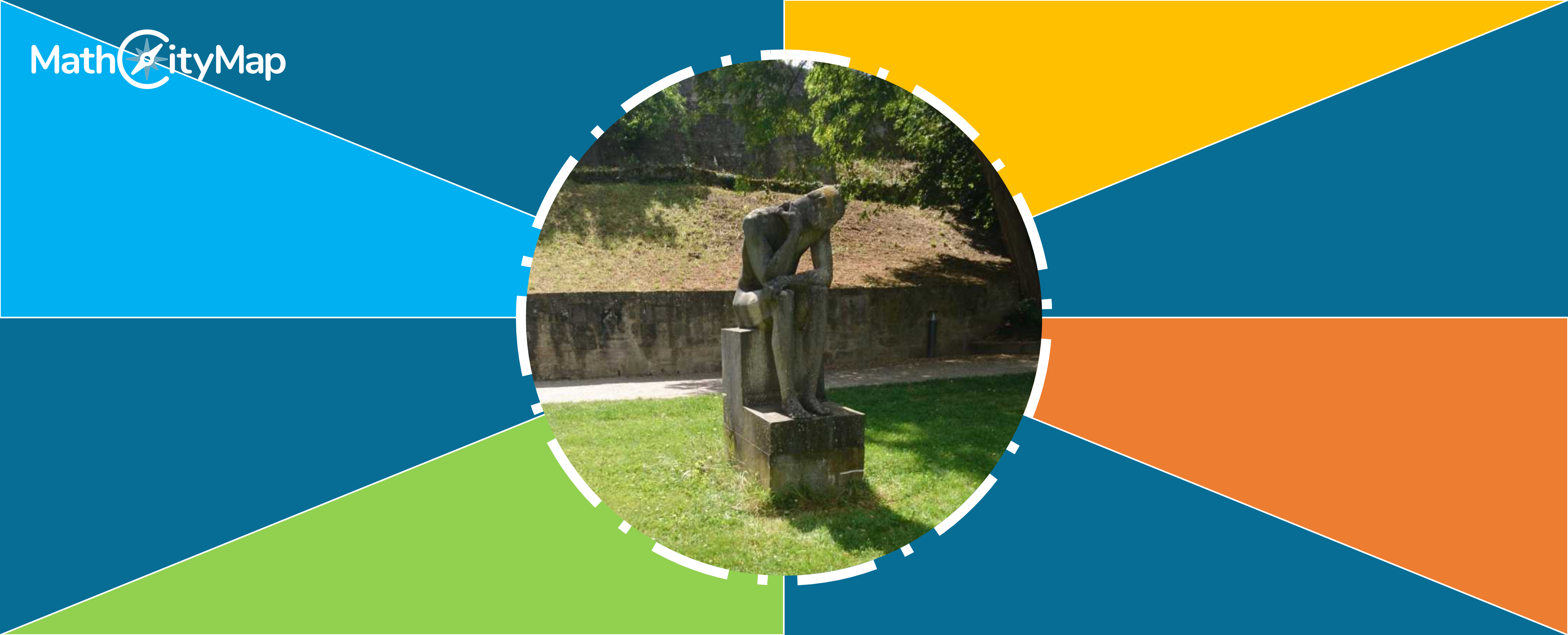
The task formulation of the 15,000th task “Shoe size of the statue” is: Shoe sizes can be determined with the help of the Parisian stitch. The number of Parisian stitches needed for the length of the foot is the shoe size. Calculate the shoe size of the statue and round your result to whole numbers. (1 Paris stitch = 2/3 cm). What is the idea behind your MCM task “Shoe size of the statue”?
Since this task is probably the first one of the trail, it should be an easy start. To avoid that the students are confused and immediately overchallenged by the task, the first hint should make clear what the first step is. First of all you need the length of the foot, i.e. you have to measure it. So the first hint should show that it is easier to solve a task in steps.
In order to solve a task correctly, one must always understand what exactly is required. The second hint is to help the students to find the right steps when they do not know what is required. After that only the actual solving of the task is missing. The task can be solved in different ways. As indicated in the last hint, the rule of three can be used. But another way of thinking is also possible (indicated in the 2nd hint): You ask yourself how many Parisian stitches fit into the foot length, i.e. the length divided by the Parisian stitch.
The statue to be examined has a foot length of 39 cm. Using the rule of three (or by dividing the foot length by the Parisian stitch), it can now be calculated that this equals shoe size 59.
Development of the number of registered users and task on the web portal.
In June, we celebrated the 5,000th user joining the MCM community, now there are already 5260 users. In the past two weeks, 381 new tasks were created, so that we now have a total of 15,381 tasks (as of 04.08.2020).
The MathCityMap team thanks all users for their multifaceted ideas. We are looking forward to many more tasks and trails!
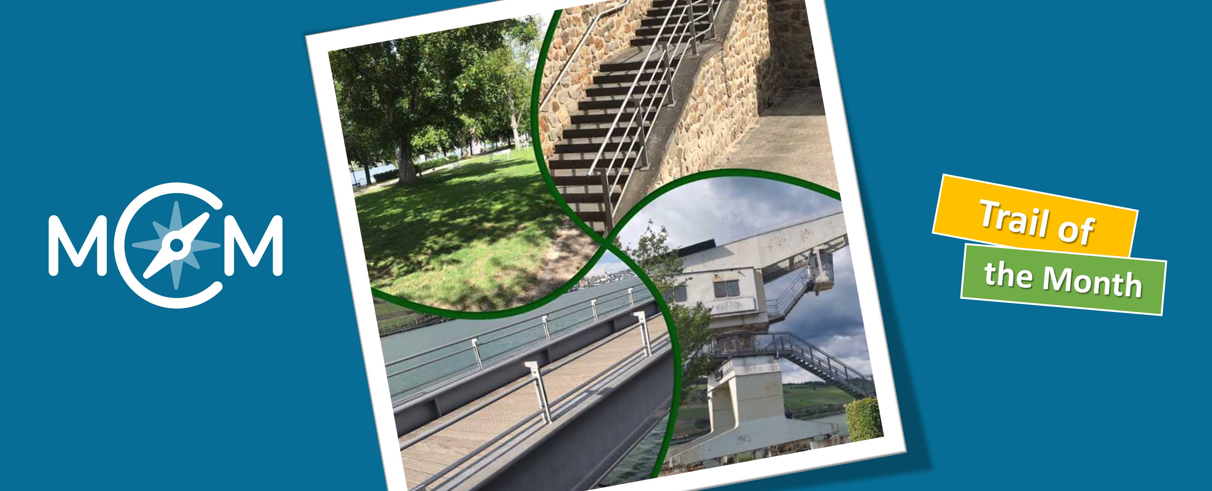
Our new trail of the month is located in beautiful Bingen on the Rhine, where Alysha Kremmelbein, a student at Frankfurt’s Goethe University, has created the “Mathtrail am Rhein” (engl. “Math Trail along the Rhine”). In the following interview Alysha answers some questions about her trail, which was created during a seminar on MCM for student teachers and was tested by our MathCityMap educators Iwan and Simon (click here for the article).
Note: This article is the start of our upcoming series “Trails in the Rhein-Main area”. In this section we would like to introduce you to the mathematical trails developed by the students in the Mathtrail seminar. All trails have been tested by students on location and have also passed our expert review.
But now finally to the “Mathtrail am Rhein” by Alysha Kremmelbein: Hello Alysha, please describe the main contents of our Mathtrail seminar. What was it about?
In our seminar we first learned general didactic as well as mathematical didactic aspects, in relation to the MathCityMap system. I focused on the topics “station work”, “extracurricular learning places” and additionally recorded a podcast on the topic “requirements for good mathematical tasks”. After that we focussed on the MathCityMap App. What does a good task look like? What criteria must it meet? And what are the requirements for a good trail? We investigated this mainly by running already published trails and creating our own trail. In this context my “Mathtrail am Rhein” was created.
Describe your trail. What is special about the trail? For which grade did you create this trail?
My trail includes 18 tasks that can be solved at the Rhine promenade in Bingen. This place is not only beautifully situated for tourism, but also traffic-calmed and offers many opportunities to get together with a school class. The trail covers a wide range of mathematics topics. From potencies and geometric objects to stochastic topics and equations, much is represented in the trail. The main trail contains easier and more difficult tasks that can be solved by ninth graders. In addition, there are two shorter trails (“Mathematics at the Promenade” and “Trail in Bingen on the Rhine”), one with a more challenging and one with an easier level of difficulty. The easier trail can already be done by seventh grade students.
Is there a task that you particularly like?
I find the task „Wasserspielplatz“ (engl. “water playground”) particularly interesting, as it can be solved in many different ways. In this task, students should determine how many pump strokes of a water pump are needed to fill a pool. First of all, they have to calculate the volume of the pool, with a hexagonal base area. The volume must then be converted into litres and then offset against the water volume of a pump stroke. Of course, the pupils can also try to solve the task by pumping water themselves, but then they will be busy for quite a while.
How has the review process helped you to improve your tasks?
With the review by other people, many mistakes made before become apparent. It is very helpful if someone with a new perspective can help you. In addition, it is good if a second person checks the measurement data, because then you can see again how someone else is doing the measurement.
What did you always want to say about MCM?
I find the app very exciting to show students the different applications of math in the environment. It’s also fun to discover mathematics in this way. I could already inspire some of my friends, who are not normally involved in mathematics, for the math trails.
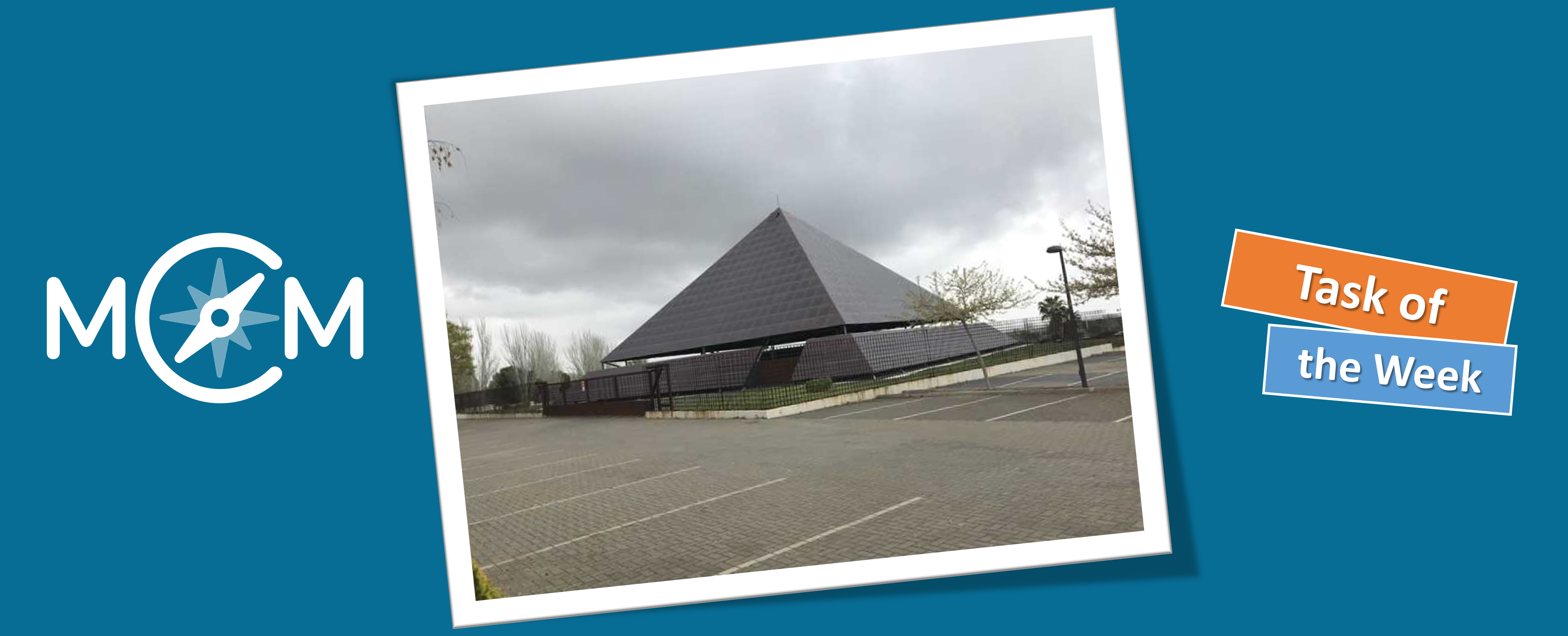
Our new Task of the Week is located in Spanish capital Madrid. There, Juan Martinez created the task “Puerta N.O. Parque Juan Carlos I (Pirámide Solar)” [engl.: Entrance to the park Juan Carlos I (Solar Pyramid)].
The task author Juan Martinez is a member of the Spanish maths education association FESPM, which is one of our project partners in out Erasmus+ projects MoMaTrE and MaSCE³. Both aim to the further development of the MathCityMap system in order to show students the “hidden” mathematics in their own environment.
The task formulation is as follows: Entering the Juan Carlos I Park, through this door we observe on the left a Solar Pyramid. What is the total area of the roof, using one square solar panel as a unit? The pyramid has four triangular sides of equal size. We count 25 whole solar panels on the base side and 15 vertically stacked panels. Taking the cut panels into account, we can calculate that the sides of the pyramid are composed of approximately 830 solar cells.
This task is to approximate the lateral area of a pyramid using a non-standard surface unit. Since the object is quite large, the students should use the triangular area formula to calculate the number of solar collectors und recognize this procedure as an effective counting method.