On the 11th and 12th September 2018, the annual MNU conference Berlin/Brandenburg took place at the Freie Universität Berlin. MathCityMap was represented as well.

In the main opening lecutre, Prof. Dr. Matthias Ludwig presented possibilites to include mathematics in an out-of-school-environment. Next to classical methods, the focus was furhter on GPS-based technologies and the use of mobile devices. About 200 participants gotto now outdoor mathematics as a chance to transfer their normal classroom teaching.

A strong interest was on the workshop “MathCityMap – live and interactive” hold by Prof. Dr. Matthias Ludwig und Martin Lipinski.


With help of the MathCityMap-App, measuring instruments and great motivation among the participants, the tasks around the campus were solved. As an example, we want to show the slope of the spiral staircase.


Finally, the participants created own tasks in the webportal (www.mathcitymap.eu), which were used to create an own small math trail.

With this great summer weather, it is no wonder that the math trailers move outside. We are very pleased that this week the 4000 task border was reached in the portal.

Outdoor mathematics with MathCityMap around the globe is achieved with help of currently about 1500 users. Together, over 600 routes were created in 17 different countries. Significant actors are next to our international cooperation partners of MoMaTrE and the MOOC of the University of Turin of course the many motivated task creators who use MathCityMap at their school, university or in their free time. Thanks a lot!

As a result, we can observe a great development of the project and are already making future plans!

MathCityMap was mentioned in the Mainpost Gemünden. Read the English version below.

With ruler and measuring tape, two classes of the Theodosius Florentini School ran a math trail in Gemünden’s old town under the guidance of the project seminar “Math Trail”.  This was reported by Anna Hellinger and Anna-Lena Haas (both Q11) in a press release.

Using the MathCityMap app of the Goethe University in Frankfurt, the 11th-grade students, under the direction of Henrike Hohmann, designed creative tasks that together resulted in two varied math trails for the 7th and 10th grade. With increasing sunshine, the mood of the students also increased and they got to know a new, practical side of the otherwise rather theoretical subject of mathematics. This was also reflected in the feedback, because contrary to the expectations of many students, mathematics can be quite enjoyable, the press release states.

After a long planning and after the “Math Day”, the first big milestone goal of the project seminar has been reached. In the near future, the trails for the 7th and 10th grade Gymnasium will be published so that they are freely accessible to the general public via the MathCityMap. In addition, a “family trail” is planned whereby the required material will be provided in the Tourist Info in Gemünden. Thereby, the students of the project seminar want to support not only the mathematics, but also the sightseeings of the “Three Rivers City”.

We are very pleased that MathCityMap was honored by the German Mathematical Association (Deutsche Mathematiker Vereinigung DMV) as “Math doer” of the month June. In doing so, special commitment and creativity in the use and handling of mathematics are recognized. For our entire team, this award is a great honor, because “Math oder” honors exactly what marks MathCityMap – doing mathematics in the environment.

On the DMV side Matthias Ludwig gives an insight into the project development, as well as ideas behind MathCityMap (English version below). We hope you enjoy reading and thank you for the interview!

Interview – English version

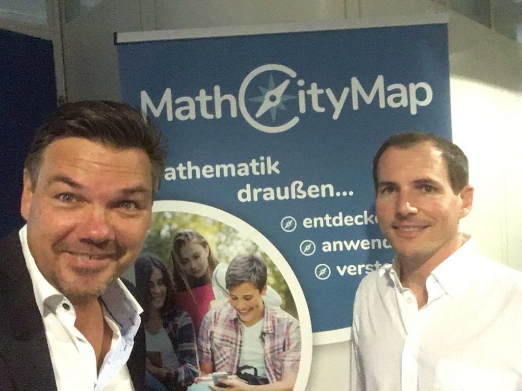
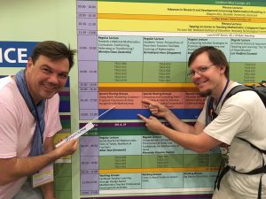
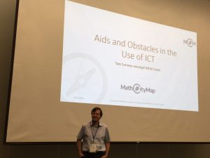
“Math Doer” of the month June 2018 are the people behind MathCityMap. The idea of ​​their app: Students walk around the area and solve measuring and arithmetic tasks at several stations that are provided by the app. There is almost nothing that cannot be used as a trail object. Sometimes they measure tree trunks to calculate their age, or how fast the steps of an escalator run. The students immediately see on the screen of their smartphone whether they are right. You also see that in many things there is a lot of mathematics and it is basically very concrete. Thousands of users, mostly teachers, have created their own nature trails and shared them on mathcitymap.eu. Here, project manager Matthias Ludwig gives a look behind the scenes and reveals how the MathCityMap team wants to force its competitor Pokémon Go.

Mr. Ludwig, how did you come up with the idea for MathCityMap?

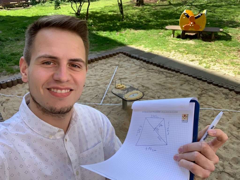
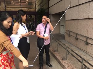
As I was still teaching, I liked to lead my students away from the textbooks, out of the classroom, into the real world. With measuring and writing equipment, we walked through Würzburg’s vineyards and measured grapevines, the slope, a pond in the park or other objects in the city. A kind of outdoor station learning, whereby the students playfully gained a look for the mathematics in the things and always experienced a little adventure. The idea of ​​the mathematical trails came up in England in the 1980s. The usual tasks at the time were various: determine water speed, count combinations, and so on. Too various for a lesson. With MathCityMap we adapt trails in terms of content and time to lessons and into the twenty-first century. The mobile technologies offer new possibilities: better distribution and exchange, assistance and direct feedback on solutions. It forms a large community. Everyone can basically join in, even get creative and design and share their own trails. In addition, we can also explore the learning effects, because we link recorded data with students’ handwritten notes.

Why do you want that?

One question was how to make smartphones useful in class. So far, the literature includes more qualitative assessment of the trails à la it is great, makes fun. We conduct evaluation studies to capture the didactic benefit. For example, we found that gamification is beneficial. The students are more motivated when competing in groups for points. Otherwise, you tend to guess results. The bottom line is that it is a win-win-win situation: students are more motivated and on average learn better than the control group in the classroom, teachers have material and variety, and we learn how good the whole thing is.

How does a place become mathematically interesting?

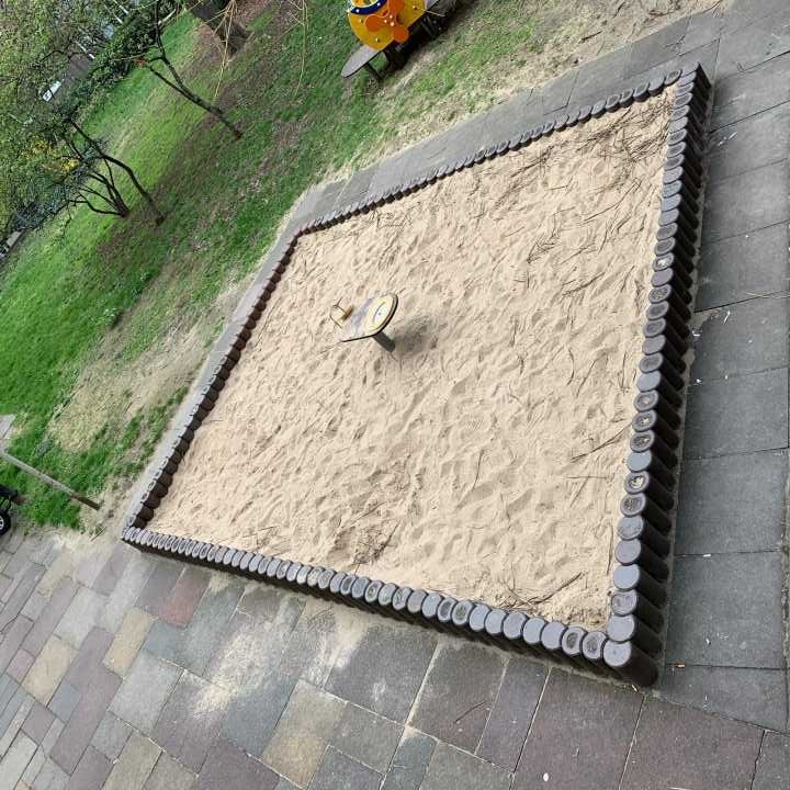
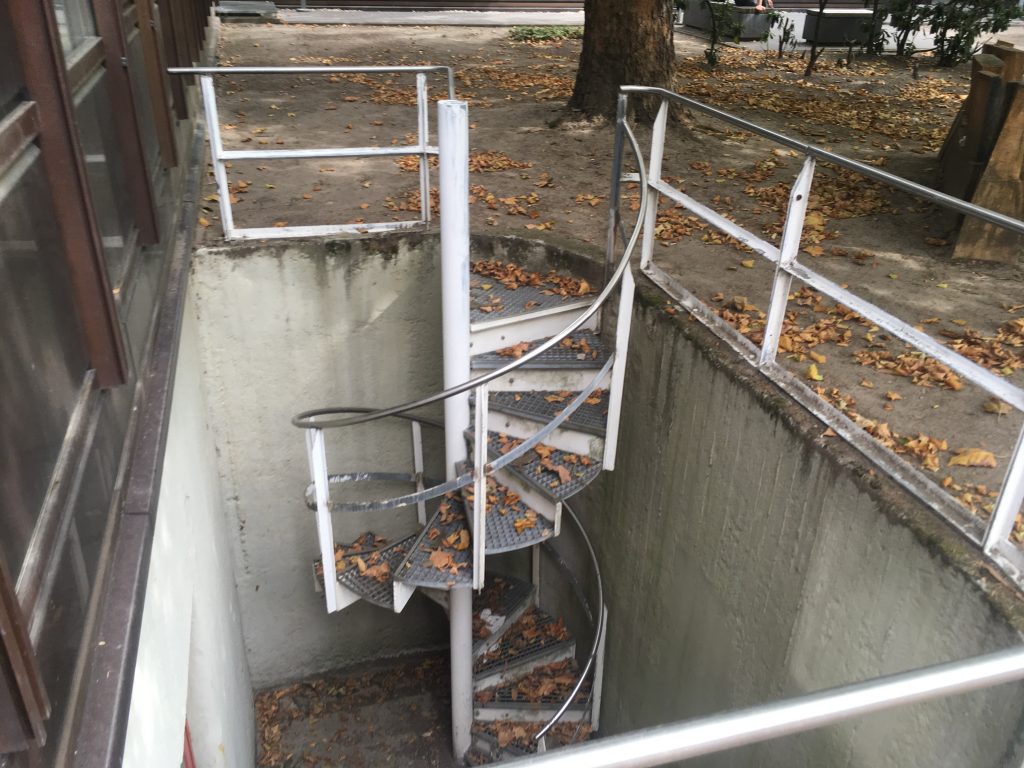
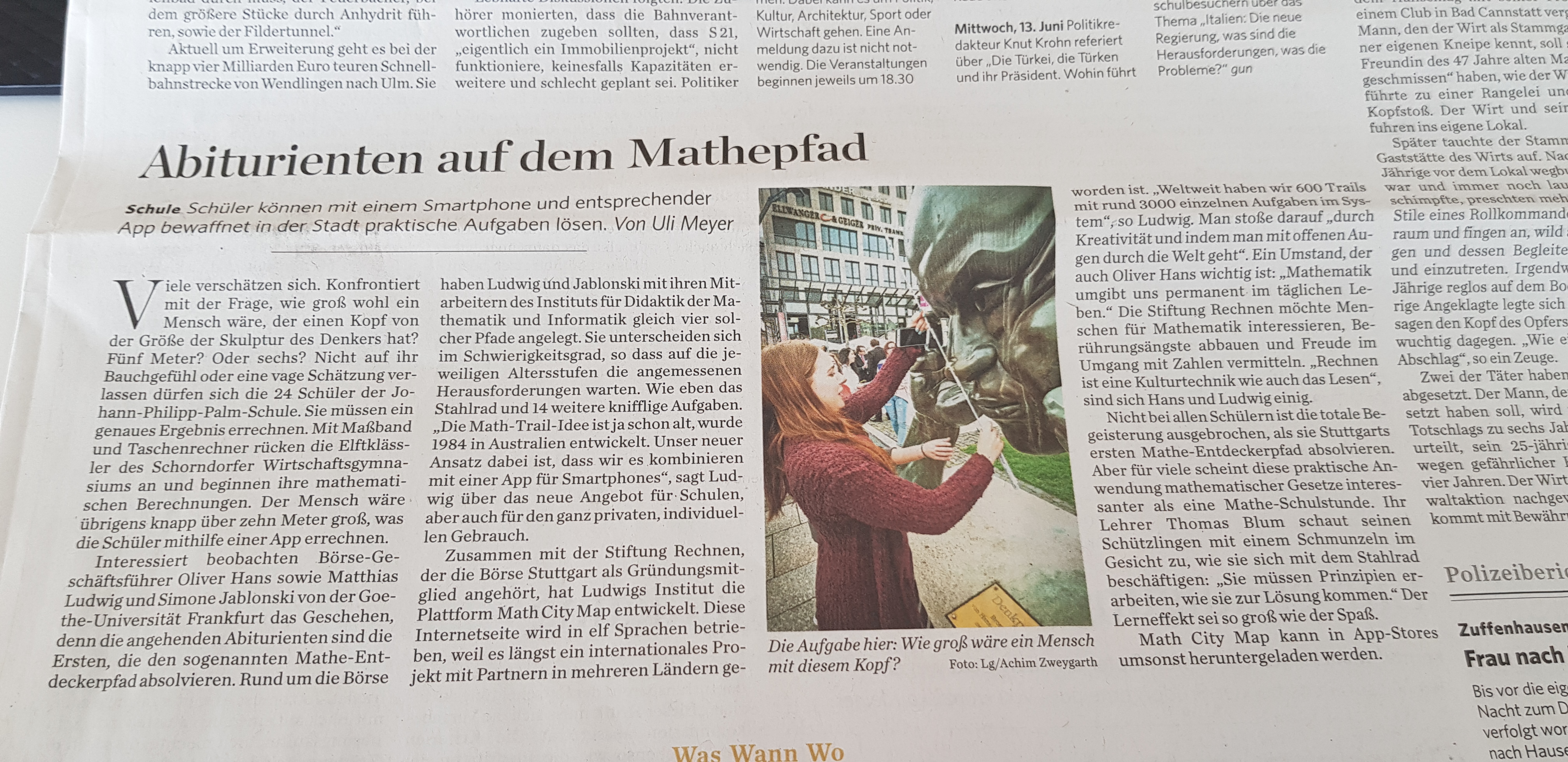
It always depends on the creativity of the user. It may be the most trivial things that are usually ignored: the pavement in the pedestrian zone, which symmetry does it have? How many paving stones are on this place? The bus stop on our street, how likely will the bus arrive in the next five minutes? The tree in the schoolyard, how old is it? This is proportional to the diameter in a certain age range. Or the statue in the fountain, which mathematical shoe size does it have? Of course you can exaggerate this with figures of the environment. Therefore, and as a kind of interdisciplinary link, we use “sidefacts” in the app, which tell a little about the history of the places.

The tasks often focus on geometry and surveying …

Yes, geometry is strongly represented. Once because it fits the school content. Then lengths, areas, gradients are practically measured and are also in the literal sense obvious, more than a probability. These schemes also spread more, because they work almost everywhere and we provide technical support when creating: With the task wizard or generic tasks, it is possible to pick up a schema and create it for my city in just a few clicks. But measuring is not everything. On the way to solution,  one also has to apply equations correctly, solve for variables and calculate with units. If the volume of a stone is required, one has to  model it mathematically, find the appropriate elementary geometric body. But also questions of analysis, combinatorics, and soon also of analytic geometry occur.

Who is MathCityMap aimed at?

Recreational mathrailers are more the exception. As a mathematics didactics, we mainly take care of the school area and lessons. We know that teachers are under pressure and have little time for additional preparation. We try to make it as easy as possible for them.

Do you check the trails created by users?

You can create private trails that only your students can access via code. There, the quality is simply ensured by your competence and the required input fields – solution hints, solution, photo, coordinates, etc. If you want to share the trail with the whole world, our team checks before the publication  whether everything is consistent and technically perfect. This is going well, also thanks to our competent project partners worldwide, who check trails in other countries. And the network is growing.

Sounds like a viral success.

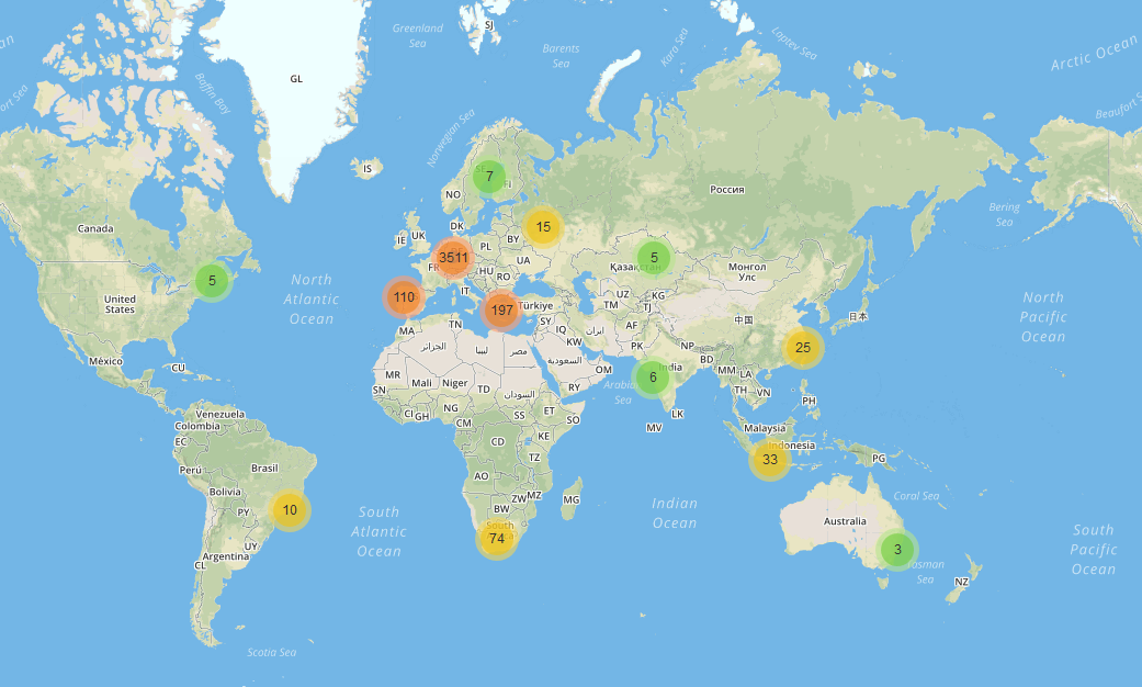
Well, still we are not a serious competitor for Pokémon Go, an app with the same gaming concept. But for people who want to get away from that stuff, we will set up distribution points for our “Mathadon”. Joking aside, there are over three thousand tasks and more than five hundred trails in eleven languages. We plan MathCityMap institutes, where further education for teachers, trail authors etc. should take place. The international exchange is enormously inspiring. I always thought I had a lot of imagination, but I always meet people who top that easily. They would create a good trail in the desert, too. That’s great! At the end of the funding period through the EU, 2020, we are making a big congress. And hope for renewal.

Thank you very much for the interview, Mr. Ludwig, and all the best for your team and MathCityMap!


MathCityMap was part of the East Asian Conference On Mathematics Education 8 (EARCOME8) which took place in Taipeh, Taiwan.

On Wednesday afternoon, about 30 participants were part of a “Special Sharing Group”, in which interested mathematics educators could make first experiences with MCM. After a typical Asian restraint in the beginning and the first cooperative solved tasks, the participants were fascinated and measured, counted and calculated diligently.

You can find the trail here.

As part of the conference, there were two further presentations given by Hanna Gärtner and Joerg Zender from Goethe University, both very successful. Joerg Zender presented the findings on the two annual surveys among MCM users.

Also in the regional edition of BILD Zeitung Stuttgart, MathCityMap and the opening of the MATHE.ENTDECKER trails around Stuttgart’s stock exchange were mentioned. In the category “What we rejoice in” it said:

This makes learning fun. From now on, four new “Mathe.Entdecker Trails” exist around Stuttgart’s stock exchange. In the app MathCityMap, objects and places become vivid math tasks.

We can only agree with this statement!

Already in the last week, we reported on the opening of the MATHE.ENTDECKER trails around Stuttgart’s stock exchange. We are happy that the event was also reported in the Stuttgarter Zeitung at the 20.04.2018 and would like to share this article with you:

High school students on the math path

School students use a smartphone and corresponding app to solve practical tasks. Uli Meyer

Many people are wrong being confronted with the question of how big a person would be with a head the size of the sculpture of the thinker. Five meters? Or six? 24 students of Johann Philipp Palm School cannot rely on their feeling or a vague estimate. They have to calculate an exact result. The 11th graders of the Schorndorfer Wirtschaftsgymnasium start with measuring tape and calculator and begin their mathematical calculations. Incidentally, the human would be just over ten meters tall, which the students calculate with help of the app. Managing Director of Stuttgart’s stock exchange, Oliver Hans, and Matthias Ludwig and Simone Jablonski from the Goethe University Frankfurt watch the happenings, because the aspiring high school students are the first to complete the so-called math discovery trail. Around the stock exchange, Ludwig and Jablonski and their staff of the Institute for Didactics of Mathematics and Computer Science have created four such trails. They vary in difficulty and challenge different ages, like the steel wheel and 14 other tricky tasks. “The Math Trail idea is already old and was developed in 1984 in Australia. Our new approach is that we combine it with an app for smartphones, “says Ludwig about the new offer for schools, but also for the very private, individual use.

Together with Stiftung Rechnen, where Stuttgart’s stock exchange is a founding member, Ludwig’s institute has developed the MathCityMap platform. This website is translated in eleven languages, ​because it has become an international project with partners in several countries. “Worldwide, we have 600 trails with around 3000 individual tasks in the system,” says Ludwig. One encounters it “through creativity and through the world with eyes open”. A circumstance that is also important to Oliver Hans: “Mathematics surrounds us permanently in our daily lives.” Stiftung Rechen would like to interest people in mathematics, to reduce fear of contact and to convey joy in dealing with numbers. “Arithmetic is a cultural technique as well as reading”, Hans and Ludwig agree. Not all students were enthusiastic when they completed Stuttgart’s first math discovery trail. But for many, this practical application of mathematical tasks seems more interesting than a math lesson. Their teacher, Thomas Blum, watches his students with a smile on their faces as they study the steel wheel: “They must work out principles as to how they can come to a solution.” The learning effect is as great as the fun.

MathCityMap can be downloaded for free in App Stores.

The MathCityMap team thanks our MoMaTrE partners from Portugal for a special outdoor event with MCM. Read their impressions in the following article by Amélia Caldeira and Ana Moura:

In the center of Matosinhos, a city in Porto’s metropolitan area, in Portugal, the mathematics was breathed with the event “Matemática vai ao Jardim” (Math goes to the Garden) on March 23rd. This event aims to celebrate mathematics and its relevance in everyday life, and in the progress of society. The main idea of this celebration was to use the students’ mathematical skills in the real world.

In a fun and innovative way, 170 students from Augusto Gomes Secondary School, equipped with a smartphone and the MathCityMap app (MCM app), answered several mathematical challenges, having as a backdrop the Garden Basílio Teles, in Matosinhos, and all its surroundings.

It was a competition between teams of three or four students.  All of them benefited from an outdoor activity: they left the school building, walked around and explorde the center of Matosinhos.

Using their mathematical knowledge, they solved the proposed tasks. All the tasks were in accordance with the knowledge level in which the team was in. Three math trails, with five tasks each, were designed: a route for 7th and 8th grade students, a route for 9th grade students, and another route for students from the 10th to the 12th grades.

Through the MCM app, students went on an outdoor walk along a route and solved math problems that were contextualized with the surrounding environment. The students passed through special places in Matosinhos, where math can be experienced in everyday situations. For example, a swing to calculate angles measures, lake bridge to calculate areas, garden benches to apply combinatorial calculus,…

The map with the location of the fifteen tasks is showed in figure 1:

Fig.1 – location of the fifteen tasks

In the end, the best team was selected from each of the three routes. The criteria for choosing the best team was the highest number of correct answers. In case of equality, the team that answered in the minimum time.

Both students and teachers of Augusto Gomes enjoyed the event “Matemática vai ao Jardim”.

Fig.2 – students measure the circumference of a sphere

You can find a briefly video-report here (https://www.youtube.com/watch?v=Jr9XwMFfUnc&feature=youtu.be).

ISEP/P.Porto team who designed and invigorated the event:

Amélia Caldeira, Ana Moura, Ana Júlia Viamonte, Isabel Figueiredo, Helena Brás, Alexandra Gavina and Alzira Faria.

MATHE.ENDTECKER (Math Explorer) is a program funded by Stiftung Rechnen in cooperation with Goethe University. MathCityMap gives the technical, didactical and pedagogic basis for this special program.

Through the opening of these trails at Stuttgart’s exchange through Patrick Dewayne (Ambassador of Stiftung Rechnen), Dr. Oliver Hans (head of Stuttgart’s exchange) and Prof. Dr. Matthias Ludwig (Goethe University, working group MATIS I), MCM reached a new level in terms of dissemination and cooperation with Stiftung Rechnen and further partners.

Dr. Oliver Hans, Prof. Dr. Matthias Ludwig, Patrick Dewayne,  (c) Philipp Tonn

On Thursday, 12.04., students from 11. grade of a commericial high school in Schorndorf were able to test one of the four trails. The feedback was positive, especially the connection of being outside, acting independently, doing mathematics and using mobile devices was mentioned. It is planned to created further trails in Schorndorf with help of MathCityMap.

Students of Johann-Philipp-Palm school in Schorndorf

The MCM team from Frankfurt is looking forward for further tasks.

Ceremonial cutting off the tape in front of the sculpture “thinker” close to Stuttgart’s exchange. From left to right:Patrick Dewayne, Prof. Dr. Matthias Ludwig, Oliver Hans. Students of Johann-Philipp-Palm school Schorndorf.

As part of the 109. MNU Bundeskongress, we were able to use and present MCM in the Bavarian capital city.

Iwan Gurjanow and Simone Jablonski presented the MathCityMap idea in a workshop, which asked the teachers to test and create MCM tasks. The trail around TU Munich-Garching can be found here.

In Munich’s city center numerous tasks could be created as well. Through a wide range of historical buildings and interesting objects, we can create a trail that involves a variety of tasks. It will be available in our portal soon.

Special thanks to the organisators and the participants for their active cooperation and constructive talks. We are sure that the MCM team will come back to Munich!