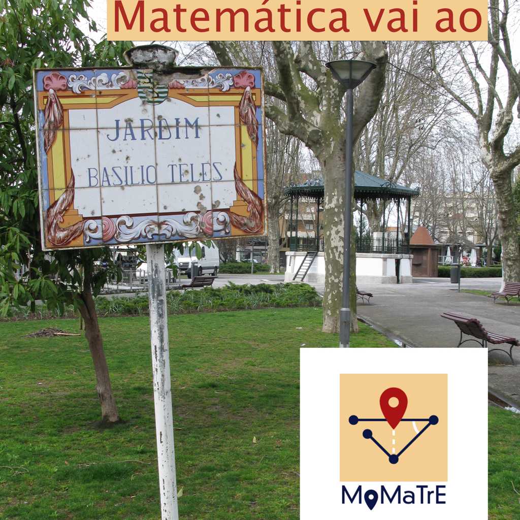
In the summer semester of 2022, Dr. Susanne Podoworny offered a seminar on MathCityMap for master students of elementary school teaching at the University of Paderborn. We would like to present a report about the implementation of this great seminar idea in this article.

The goal of the seminar was to create and implement a mathematical trail using the MCM app with elementary school children on a suitable theoretical basis.

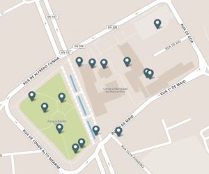
In the area around Paderborn, two elementary schools could be won over, which agreed to carry out a mathematical trail with five first and two second classes later on.

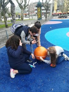
After a few sessions in which the students explored theoretical backgrounds on learning in out-of-school places, learning with digital media, and of course MathCityMap, four student groups formed to create four mathematical walking paths with MCM. The students found it particularly challenging to create appropriate tasks for the still very young target group. One student wrote in this regard “It’s very difficult to formulate tasks for first grade when the kids can barely read.”

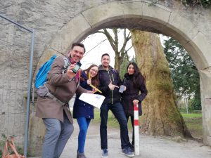
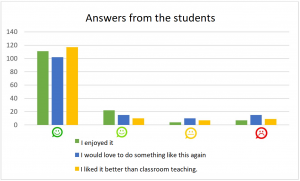
The implementation then took place in a double lesson at each of the two elementary schools. The trails were designed along the schoolyards and often referred to the playground equipment. Overall, the student teachers reported that the students involved, as well as the teachers, greatly appreciated this different mathematics lesson. A questionnaire was distributed to the students by the students and 145 children completed it. Some results can be seen in the following diagram.


As a hint from the implementation, the recommendation to integrate a read-aloud function into the MathCityMap app arose, which we gladly take up for the further development of our system.

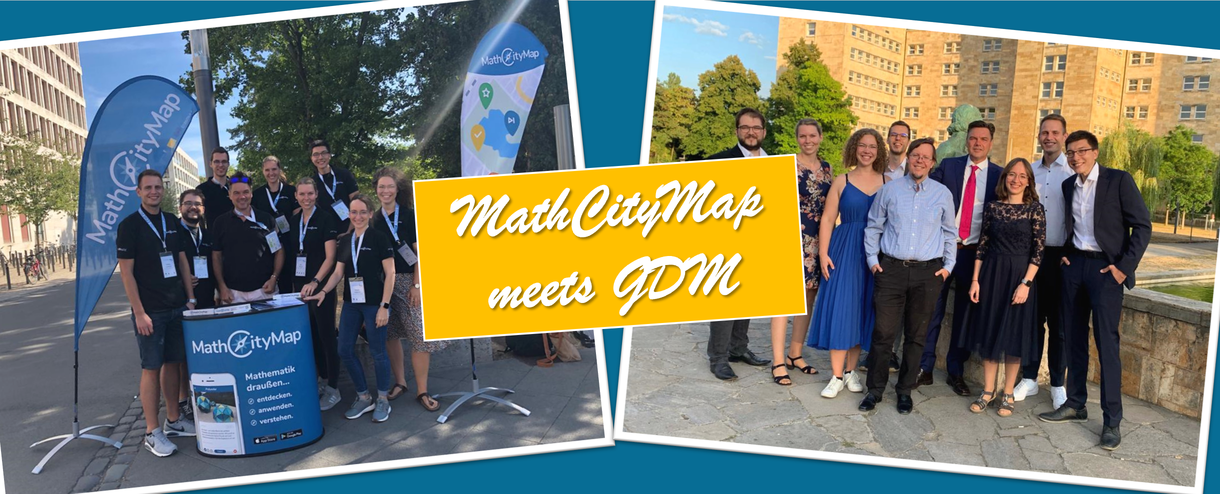
The seminar was well attended with 24 students. On the one hand, the students appreciated the freedom offered by the seminar design and, on the other hand, the real-life work with elementary school children, which gave everyone a lot of pleasure. Due to the positive response from the students, this seminar will be offered again in the winter semester.


As in previous years, it was a special pleasure for our team in Frankfurt to present the ideas and potential of MathCityMap at the recent annual conference of the Gesellschaft für Didaktik der Mathematik (Society for Didactics of Mathematics).

As the largest conference for didactics of mathematics in the German-speaking countries, the GDM annual conference not only offers us the opportunity to discuss current research on MathCityMap and the idea of app-supported mathematical walking paths with the scientific community and to generate new ideas for the further development of the MathCityMap system. In addition, we were able to promote the enthusiasm and understanding for the concept of making mathematics experienceable and learnable outdoors with a workshop for teachers on MathCityMap and an information desk on the conference grounds.

We were again able to gain some new impulses for our work and are already looking forward to the appearance of the many contributions on MathCityMap in the conference proceedings of the GDM, which we will of course also link for you on this website.


We are very happy to welcome again two schools in our partner school program. This time it is the “Zakladna skola Janka Matusku” from the city of Dolný Kubín in the north of Slovakia and the “Pombal Secondary School” from Pombal, a city in Portugal.

Both schools successfully completed the necessary application process. In Pombal, teachers Diana Santos, Ana Medeiros, Teresa Oliveira and Margarida Fonseca worked together on a total of three trails, each focusing on a different grade level and different content.

“The students were very enthusiastic and participative in this, and there was great feedback from the students that the knowledge they had acquired during the school year was applied in a different and more fun way” Diana Santos told us.

In Dolný Kubín, two diverse math trails were created by math teacher Klaudia Kovalcíková and tested with her students. She reports about the experience in the application process as follows:

“I have been working in education for about 3 years. In that short time, I have found that the most popular question my students ask me is, “What are we going to use this school stuff for? Where will I use this knowledge in my life?” So, instead of a humble answer, the idea of creating a math trail was born to show students how to apply math directly in the real world, in our city or in their environment. During the school year we made several trails through the town of Dolný Kubín. Dozens of photos of various objects, buildings and parks were taken and the students learned how to work in the Mathcitymap portal. They suddenly discovered that mathematics is not only a school subject, but it is in almost every object. It must be not only about its visual form, but also about its content value (for what reason was this object created, what does it symbolize, when was it built, …). We pass many memorial / information boards every day, but only now have we discovered that they not only reveal many mathematical possibilities for their use, but that thanks to them we also learn about the history of our city and its people.”

One of the students there also shared his experience with MathCityMap for us:

“Math Trails have given me more than just attending a regular class. What was the goal? We created tasks that we implemented outdoors, in a digital classroom. We learned about the town of Dolný Kubín and its history from a mathematical perspective. I would also like to thank our teacher Mrs. Kovalčíková for this opportunity.

I often go to Námestovo, but only now I found out that there is a statue of Ján Vojtaššák in front of the church (when we measured it with the other students). Until now, a meter for me was three thirty-centimeter yardsticks and a few centimeters more. Today, one meter is equal to two-thirds of a park bench, for example. I can calculate the volume of the bench, I know how many poles we need for it. I also figured out what the circumference of the fountain in our city is. Math was no longer just numbers, pencil, paper, ruler, interactive whiteboard…. We were outside touching our math problems, we measured them with a string, we looked for solutions together, etc. It was great. On the way home from school, I look around and think about what object will be our math problem next time. I’m looking forward to it.”

The package with the measuring tools and the official partner school plaque is already on its way to the schools and, as always, we are very much looking forward to receiving further applications from all over the world.

All further information about the partner school program and the prerequisites for the application can be found in the article about the first MCM partner school as well as on the homepage of our project MaSCE³.


A fantastic part of MathCityMap is our constantly growing international community. In this we now welcome the already fourth MCM partner school in Portugal, the “Escola EB 2,3 Dr. Pedro Barbosa” in Viano do Castelo.

The successful application process was accompanied by two pre-service math teachers, Ana Meira and Liliana Francisco, who reported on it as follows:

“Our first experience with MathCityMap was as students during our master’s program. We were so positively impressed by the app that we decided to create mobile Math Trails with our own students, two 6th grade classes. To apply the content taught in class, we created a trail about rational numbers (trail code: 099594) and another about symmetries (trail code: 145301).

Both groups reacted extremely well and enjoyed the opportunity to get outside, exploring the mathematics that surrounds them. The technology was an extra motivation, especially the gamification feature of the app and the possibility of accessing immediate feedback on their answers. The contents taught in the classroom acquired new meaning as the students could see the applicability in real context.

The package with the official partner school plaque and the MCM measuring instruments is already on its way to Portugal and we are very much looking forward to receiving more applications from all over the world.

All further information about the partner school program and the requirements for the application can be found in the article about the first MCM partner school as well as on the homepage of our project MaSCE³.


At the beginning of April, a MathCityMap advanced training course was held in Ober-Ramstadt as part of a project day for the more than 30 students of the advanced mathematics courses at the Georg-Christoph Lichtenbergschool.

The students first learned how to use MCM and then developed creative MCM tasks on the school campus for the lower and middle school. In total, the math teachers can now draw on about 50 new tasks and develop trails for their classes.

An overview of the different tasks created by the students* can be found in the trails sorted by grade level with codes 489376 for 5th/6th grade, 569374 for 7th/8th grade, and 199375 for 9th/10th grade.

The students were happy that they could create math tasks for current and future students in the spirit of sustainability. This project day showed that students can also create meaningful MCM tasks for the school community.

The project day was led by our team members Melanie Schubert and Rebecca Stäter and was carried out at the direct request of the Georg-Christoph Lichtenbergschool Ober-Ramstadt, whose teachers had already attended a MathCityMap training course in advance. If you would like to learn more about MathCityMap in the context of a teacher or student training, perhaps even directly at your school, please contact us at any time at info@mathcitymap.eu .


November’s Trail of the Month comes from the capital of the German state of Lower Saxony. The trainee teacher Franziska Hormann created the trail “Circles and bodies on the trail in Hanover”, which can be accessed in the MCM app under the code 386349. It is available in the web portal here.

On this mathtrail you will find a total of nine tasks implemented on the buildings and artistic sculptures of Hanover’s city center.


How did you come across the MathCityMap project?

As a former student at Goethe University, I was already able to get to know MCM during my studies in the module Upper School Didactics, where I also designed my first tasks. In Frankfurt, the app is widely used, so I was surprised that in Hanover, where I am currently completing my traineeship, there are only a few MCM trails and the project was hardly known among teachers or at our study seminar. However, my interest in sharing and spreading it in my home region was correspondingly great, especially since the beautiful old town of Hanover offers ample opportunities to apply mathematics…


Please describe your Mathtrail.

The Mathtrail is specially designed for the topic of circle and solid calculation, which is taught in the 10th grade in Lower Saxony. On a circular route through the old town past well-known places such as the New Town Hall, the Market Hall and Church or the Ballhof, students can apply their knowledge of the circumference and area of circles, surface area and volume of cylinders and spheres and test it on authentic problems.
The trail is particularly suitable at the end of the unit, when all the formulas are already known and the constructed tasks from the textbook have had their day. I myself tried it out as part of a project day with a 10th grade class, and since the topic is usually taught at the end of the school year in Lower Saxony, such a project day before the vacations is particularly worthwhile, on the one hand to do mathematics in the world around us at an extracurricular learning site, and on the other hand to offer an alternative to the annual movie watching in the last few weeks.


How do you use MCM and why?

Since I am still at the beginning of my professional life, I have so far only used MCM for this specific trail in the said 10th grade. In my opinion, MCM is especially (but not only) suitable for geometry topics, in which I will gladly use it again in other grades. On the one hand, as a teacher myself, it is a pleasure to design the tasks and to rediscover old familiar things with a different view. In addition, the possibility of publishing the paths means that other teachers can also benefit from the efforts. On the other hand, I feel it is important to experience mathematics in real-life contexts that are as authentic as possible, to become active myself and to have to puzzle. MCM can make all this possible with well-set tasks, where the groups have to coordinate and find heuristic strategies for calculating solutions together, which also promotes their ability to work in a team.
Last but not least, out-of-school learning venues are rare in the subject of mathematics. MCM makes it possible, regardless of the proximity to facilities such as the Mathematikum in Giessen, etc., to design an extracurricular learning venue that can be adapted to one’s own lessons with manageable effort and thus make mathematics experienceable in a different way.


Describe your favorite task of the trail. How can it be solved?

I believe that all tasks have their charm and sometimes require less and sometimes more modeling competence. I like the starting task of the trail with the Hase fountain, for example, because in the beautiful brick backdrop between the Old Town Hall and the Market Church, you first have to perceive this historic structure simplified as a cylinder and then come to the determination of the water volume via various paths, the circumference of the basin or the partly estimated radius, whereby the correct unit must not be neglected at the end. In this task you also have to have the courage to hold the folding rule properly in the water for once.
I like tasks where the solution is not immediately obvious and where you have to fiddle a bit without increasing frustration. That’s why the solution interval should not be too small, which I learned myself during the test.

From September 9 to October 8, we were able to collaborate with Simon Fraser University in Vancouver, Canada on a new project on outdoor mathematics and MathCityMap. Visiting the research group of Prof. Dr. Nathalie Sinclair, we dedicated ourselves to research on embodiment and gestures while walking a mathtrail: When students work on real objects, it seems natural that they interact with the object and describe mathematical concepts through gestures.


We started by looking at the SFU campus, and we didn’t have to search long for suitable tasks! Not only the pyramid seemed to be made for MCM! In the course of an advanced training with 20 teachers, the tasks could then be tested directly. Afterwards, five groups were filmed solving the tasks. In the evaluation, we will focus on when and with which function different gestures were used. We will submit these results at the next PME conference (2022 in Valencia).

Of course, we did not miss the opportunity to create some trails in downtown Vancouver – both the Waterfront Station and the Stanley Park were ideal addresses for our first “Canadian Math Trails”.


The study and the accompanying research stay are funded by the DAAD and the BMBF within the framework of the Project-related Exchange of Persons (PPP) Canada.

The MathCityMap team thanks our MoMaTrE partners from Portugal for a special outdoor event with MCM. Read their impressions in the following article by Amélia Caldeira and Ana Moura:

In the center of Matosinhos, a city in Porto’s metropolitan area, in Portugal, the mathematics was breathed with the event “Matemática vai ao Jardim” (Math goes to the Garden) on March 23rd. This event aims to celebrate mathematics and its relevance in everyday life, and in the progress of society. The main idea of this celebration was to use the students’ mathematical skills in the real world.

In a fun and innovative way, 170 students from Augusto Gomes Secondary School, equipped with a smartphone and the MathCityMap app (MCM app), answered several mathematical challenges, having as a backdrop the Garden Basílio Teles, in Matosinhos, and all its surroundings.

It was a competition between teams of three or four students.  All of them benefited from an outdoor activity: they left the school building, walked around and explorde the center of Matosinhos.

Using their mathematical knowledge, they solved the proposed tasks. All the tasks were in accordance with the knowledge level in which the team was in. Three math trails, with five tasks each, were designed: a route for 7th and 8th grade students, a route for 9th grade students, and another route for students from the 10th to the 12th grades.

Through the MCM app, students went on an outdoor walk along a route and solved math problems that were contextualized with the surrounding environment. The students passed through special places in Matosinhos, where math can be experienced in everyday situations. For example, a swing to calculate angles measures, lake bridge to calculate areas, garden benches to apply combinatorial calculus,…

The map with the location of the fifteen tasks is showed in figure 1:

Fig.1 – location of the fifteen tasks

In the end, the best team was selected from each of the three routes. The criteria for choosing the best team was the highest number of correct answers. In case of equality, the team that answered in the minimum time.

Both students and teachers of Augusto Gomes enjoyed the event “Matemática vai ao Jardim”.

Fig.2 – students measure the circumference of a sphere

You can find a briefly video-report here (https://www.youtube.com/watch?v=Jr9XwMFfUnc&feature=youtu.be).

ISEP/P.Porto team who designed and invigorated the event:

Amélia Caldeira, Ana Moura, Ana Júlia Viamonte, Isabel Figueiredo, Helena Brás, Alexandra Gavina and Alzira Faria.

Doing outdoor mathmatics with MathCityMap works in any weather. Iwan Gurjanow and Matthias Ludwig visited the cathedral city Erfurt on Wednesday 21.03. and Thursday 22.03. On the 24th Days of the maths and science lessens of the ThiLLM, we were able to present MathCityMap. While the preparations on Wednesday took place in cold but sunny weather, there were some brave teachers who ignored the sleet and solved MCM tasks at the campus of the University of Erfurt and later created own MCM tasks in the portal. Of course, in such a beautiful city, we were also searching for tasks in the city center. The finished trail in Erfurt’s old town will be presented here in the next few days.

As part of the joint meeting of GDM and DMV in Paderborn from 05.03. – 09.03.2018, MathCityMap was presented in various ways. First of all, on 06.03. Matthias Ludwig spoke on the Erasmus + project MoMaTrE (Mobile Math Trails in Europe), in which the cooperation partners and goals were presented on an international level. On 08.03., Iwan Gurjanow presented his research results in the field of motivation and gamification (points and leaderboard) while running a math trail. In addition, Joerg Zender considered the Math Trail idea from the point of view of performance, which led to interesting discussions on 09.03.

A special highlight for the entire team is the prize which Daniel Birnbaum and Matthias Ludwig won at the poster session. On the poster, the future-oriented technology Augmented Reality was presented, as well as first ideas to use it in school and MCM.

During the entire conference, the participants had the opportunity to test a trail in the city center of Paderborn. Of course, we took the chance and ran the trail from the perspective of the task solver with lots of fun and ambition.

At this point, we want to thank Max Hoffmann and the students of the Pelizaeus-Gymnasium for creating the tasks! Likewise, we would like to thank all interested in the project for the exciting questions and discussions.