Matthias Ratering has already held several teacher trainings in South Tyrol on the use of MathCityMap and MCM@home. In this interview, he presents his trail to the MCM@home webinar and explains to us what potential he sees in our Digital Classroom feature.


What is your webinar about? How are you using MathCityMap?

Teacher training is one of my areas of work. For that I organized a webinar for teachers to learn about MCM and test the possibility of using it in distance learning. Normally, of course, I prefer to use it outdoors. However, MCM’s digital classroom offers a delightful alternative for distance learning, but not only.

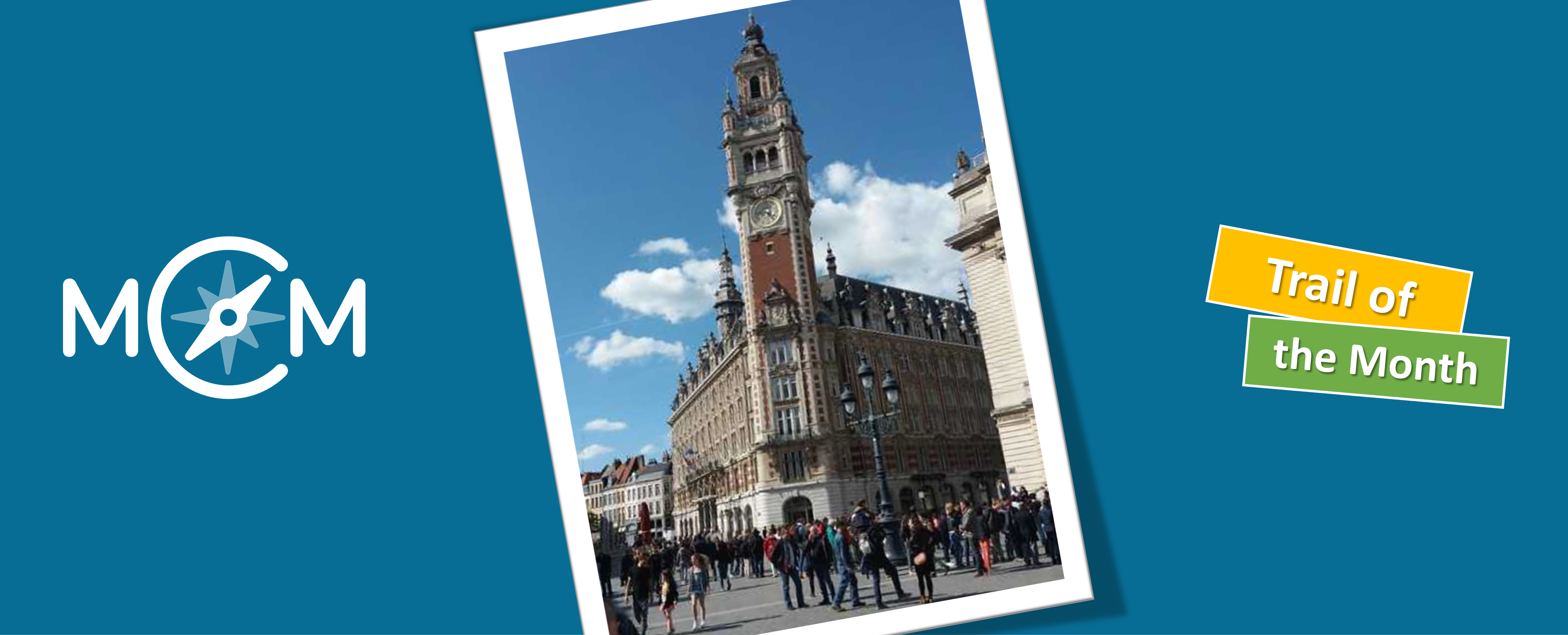
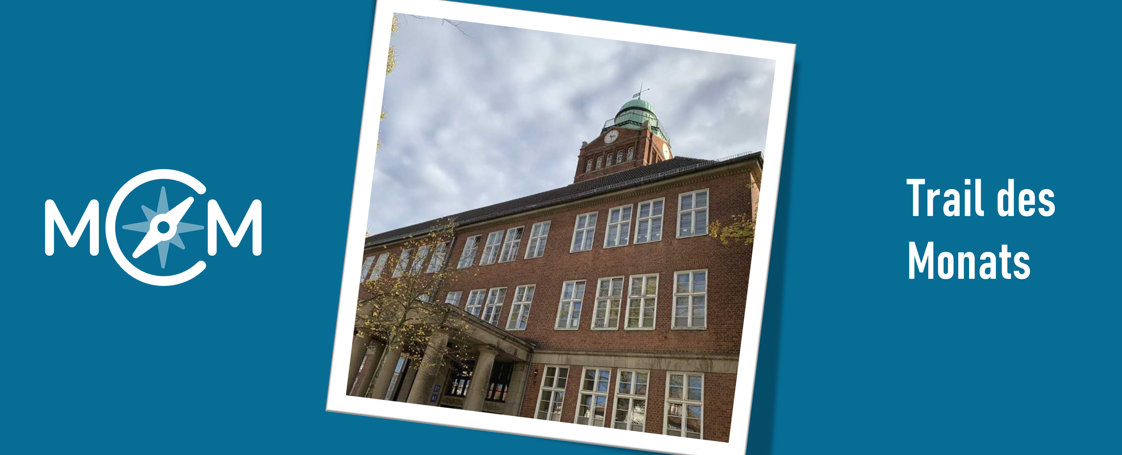
Note: The trail to the webinar can be found here.

Describe one of your assignments. How can it be solved? What can learners (or webinar participants) learn in the process?

The task “Fasching” is about a father who wants to dress up and has several hats and ties to choose from. The children are asked to think about how many possible combinations there are. It is not necessary that the children have studied combinatorics in class. A discovery approach to this subject area is possible.

How can MathCityMap be used for distance learning (MCM@home)? What opportunities and limitations do you see?

The digital classroom is a very practical tool. This tool allows me to have a better overview of each student, who is working on what or who has already done what. In addition, it is often useful because you can communicate with the children in chat and thus support them. The digital classroom also helps me get additional feedback on my students after they have completed the questions.

Any other comments about MCM?

MCM is a tool that is constantly evolving and has a community that is always growing. As such, it would be nice to see more teachers from other subjects join in the future to enrich the design of trails. I believe that there is still a lot of potential here and that great interdisciplinary projects can be realized.

Severin Philippe, a math teacher of Lille, is the author of our current Trail of the Month. Last year, he created the math trail Balade autour des monuments de Lille (Code: 361576) in order to organize a mathematical city walk through Lille for European exchance students.

How do you use MathCityMap?

In January 2020, I organized the trail for my students and their German, Romanian and Italian penfriends during the Erasmus+ exchange week in France. I use MathCityMap every year with my students and one of my colleagues who teaches French – students have to look for information about Lille monuments before the trail.

Please describe your trail. Where is it placed?

I used to do this trail before and I discovered the MathCityMap application only afterwards. This city centre trail of Lille is the first one I have created so far.

Why did you create this route? Which didactic aims do you want to stimulate through this trail?

I created this trail because it’s important to me to show my students that mathematics is everywhere around us. The students tend to be more active and motivated outside the classroom.

Trail of the MonthTrails in the Rhine-Main region

Today we present part 2 of our interview with Jens-Peter Reusswig about the Trail of the Month October (link to part 1). The math trail “Zur Dicken Tanne” was created during the MathCityMap seminar at the Goethe University in Frankfurt.


Please introduce a task of your trail in more detail.

I especially like the 8th task “Ene, mene, miste”. At this trail station there are different pieces of wood hanging in a frame. Although they differ in their composition, it is difficult to assign them to a suitable tree species without appropriate knowledge.

The task now is to find out how many pieces of wood come from beech trees and calculate the probability of randomly pointing to one. Fortunately, however, an information board hidden under a cover helps to identify the pieces of wood.

The counting rhyme in the title already gives a first intuition for the task. Furthermore, the integration of the forest teaching garden of the Schutzgemeinschaft Deutscher Wald (German Forest Conservation Society) makes use of the learning opportunities on site in the trail, which makes the connection between mathematics and ecology particularly clear once again.

How has the review process helped you to improve your tasks?

Through the peer review process during the in-depth seminar, the trail was subjected to an initial feasibility check. One of the seminar participants not only checked whether the tasks were comprehensible and solvable for others, but also whether the trail took into account the essential MCM criteria and whether the tasks could only be solved on site, for example.

In her feedback she drew my attention to misunderstandings, linguistic inaccuracies and alternative solution strategies. For example, during the conceptual design of the tasks it can happen that the view is too attached to the task object. In one case, for example, I eventually faded out a signpost on the task picture, which presented a danger of confusion with the information signs from the task. However, this eye-opening hint helped to prevent discussions about the sign meant and to avoid frustration at the station by a wrong result.

The feedback from the publishing process via the MCM web portal allowed me to do a final fine-tuning. The feedback from the MCM expert team helped me to further specify my tasks and solutions. For example, this enabled me to put the task notes in a more sensible order and gave me an idea of what makes a good MCM task.

Further comments on MCM?

I can recommend MCM to everyone who enjoys mathematics and everyone can contribute to making MCM even more interesting in the future. You don’t have to be afraid of the publishing process, because you will always receive appreciative feedback from the MCM experts.

Sharing the trails helps to increase the awareness of MCM and offers mathematics fans the opportunity to try out trails in their own environment and to gather ideas. Because one thing is clear: MCM lives from the participation and contributions of many other locally engaged MCM heroes.

Information about the trail:

Name: Trail to the “Thick Fir
Code: 362883
Location: 63579 Freigericht Somborn
Target group: from grade 9
Topic: Mathematics and Ecology

Trail of the MonthTrails in the Rhine-Main region

Our new trail of the month is located in beautiful Bingen on the Rhine, where Alysha Kremmelbein, a student at Frankfurt’s Goethe University, has created the “Mathtrail am Rhein” (engl. “Math Trail along the Rhine”). In the following interview Alysha answers some questions about her trail, which was created during a seminar on MCM for student teachers and was tested by our MathCityMap educators Iwan and Simon (click here for the article).

Note: This article is the start of our upcoming series “Trails in the Rhein-Main area”. In this section we would like to introduce you to the mathematical trails developed by the students in the Mathtrail seminar. All trails have been tested by students on location and have also passed our expert review.


But now finally to the “Mathtrail am Rhein” by Alysha Kremmelbein: Hello Alysha, please describe the main contents of our Mathtrail seminar. What was it about?

In our seminar we first learned general didactic as well as mathematical didactic aspects, in relation to the MathCityMap system. I focused on the topics “station work”, “extracurricular learning places” and additionally recorded a podcast on the topic “requirements for good mathematical tasks”. After that we focussed on the MathCityMap App. What does a good task look like? What criteria must it meet? And what are the requirements for a good trail? We investigated this mainly by running already published trails and creating our own trail. In this context my “Mathtrail am Rhein” was created.

Describe your trail. What is special about the trail? For which grade did you create this trail?

My trail includes 18 tasks that can be solved at the Rhine promenade in Bingen. This place is not only beautifully situated for tourism, but also traffic-calmed and offers many opportunities to get together with a school class. The trail covers a wide range of mathematics topics. From potencies and geometric objects to stochastic topics and equations, much is represented in the trail. The main trail contains easier and more difficult tasks that can be solved by ninth graders. In addition, there are two shorter trails (“Mathematics at the Promenade” and “Trail in Bingen on the Rhine”), one with a more challenging and one with an easier level of difficulty. The easier trail can already be done by seventh grade students.

Is there a task that you particularly like?

I find the task „Wasserspielplatz“ (engl. “water playground”) particularly interesting, as it can be solved in many different ways. In this task, students should determine how many pump strokes of a water pump are needed to fill a pool. First of all, they have to calculate the volume of the pool, with a hexagonal base area. The volume must then be converted into litres and then offset against the water volume of a pump stroke. Of course, the pupils can also try to solve the task by pumping water themselves, but then they will be busy for quite a while.

How has the review process helped you to improve your tasks?

With the review by other people, many mistakes made before become apparent. It is very helpful if someone with a new perspective can help you. In addition, it is good if a second person checks the measurement data, because then you can see again how someone else is doing the measurement.

What did you always want to say about MCM?

I find the app very exciting to show students the different applications of math in the environment. It’s also fun to discover mathematics in this way. I could already inspire some of my friends, who are not normally involved in mathematics, for the math trails.

Adrian Schrock, math teacher at the Weibelfeldschule in Dreieich (Germany), has created our new Trail of the Month. The tasks of the math trail aim at the topics Theorem of Pythagoras and the Intercept Theorem. By this example we want to show how you can create so-called theme-based math trails with close curricular links. In this interview Adrian Schrock talks about his experiences with MathCityMap.

How do you use MCM and why? What is special about your trail?

I currently use the trail „Unseren Schulhof mit Mathe entdecken“ (engl.: “Discovering our schoolyard by doing maths”) in my 9th grade in the subject area “Pythagorean theorem” and ” Intercept theorems” and would like to increase the motivation for problem solving in class.

What is special about my trail is that all the tasks are in the schoolyard and combine the topics “Pythagorean theorem” and “Intercept theorems”. Not only inaccessible variables like the height of the school building can be calculated, but also by reversing the theorems both the 90° angle and the parallelism can be checked using objects in the schoolyard.

The first task is explicitly intended as an introduction to working with the Mathtrail and should be carried out in small groups in the classroom. I have already tested this successfully in class and had the advantage that the SuS first get to know the app and possible questions can be clarified directly in the plenum.

In order to increase the relevance of the tasks, a short story is formulated in my descriptions “About the object”, which shows why the question could be interesting. For example: “Between the columns a screen for a stage set can be hung up. A teacher wants to know for a performance of the Performing Play in an open-air theatre whether the screens are parallel to each other”. The stories are, of course, made up, but may answer the question of the students “Why would you want to know that?”.

What didactic goals do you pursue?

On the one hand, the trail aims to specifically promote motivation for problem solving in the 9th grade. On the other hand, by focusing on the selected topics, the trail has the additional purpose of being able to apply the teaching content to real objects and thus deepen the knowledge. The advantage of this is that it is clear from the starting situation of the SuS that previous knowledge is required for the trail. A disadvantage is, of course, that if you work on other class levels, your motivation might be lower, because you don’t see any connection to your current lessons.

Further remarks about MCM?

Small wish to the MCM team… the Task Wizard lacks task types to determine heights or to check for example parallelism or something similar to my trail. Maybe you could add some more topics here.

I find the structure of the website and especially the feedback to the created tasks very good – thanks a lot to the MCM team!

Liina Shimakeleni, Mathematics and Science teacher at Omagongati Combined School in Namibia, created several theme-based math trails, e.g. about the topic volume, which are are new Trails of the Month. In this interview, Liina gives us an insight into the usage of MathCityMap in Africa. Furthermore, she talks about her experiences on the MCM system and her created trails.

Hi Liina, let’s start with our ‘classic’ first question: How did you in contact with MathCityMap?

I am a Mathematics and Science teacher at Omagongati Combined, I have been teaching at this school for eight years. I registered with the Rhodes University (South Africa), doing Masters in Mathematics Education. We attend contact classes in NIED Okahandja, Namibia. In 2019 Matthias Ludwig, a senior lecturer from Goethe University, paid us a guest lecture and introduced the MCM project. I embraced the whole MCM idea and thought it was in line with my research area, which is to discover how mathematics learned in the classroom is linked to real life through outdoor activities– as advocated by the MCM project.

What are your personal experiences with MathCityMap?

My very first encounter was not an easy one. After solving tasks that were set by Matthias it was our turn to set our tasks in the NIED Okahandja campus. I did not find a task that day because I did not want any mathematics task, but I wanted a task that is related to what I ask from/discuss with my learners in the mathematics class.

Your trails were downloaded very often in the last month. How do you use MathCityMap? Please describe your theme-based math trails.

I use MCM in my research to find out how Grade 9 learners use smartphones and visualization to learn measurement.

The uniqueness in my tasks is that each trail consists of tasks that are resourced from Perimeter, Area and Volume topics in school mathematics curriculum. For example, in the task ‘Volume of a tank’ learners are asked to calculate the volume of an old tank in the school ground, where they could not measure that radius of that tank directly. This task requires learners to make this complex task into simpler steps by finding the radius from circumference [C=2·π·r] and use value r to find the volume [V= π·r2·h].

Let’s have a look on Liinas theme-based math trails:

Name

Topic

Code

Number of Downloads

Omagongati Perimeter Trail

Perimeter

132336

43

Omagongati Area Trail

Area

152516

18

Omagongati Volume Trail

Volume

012527

71

Please describe the school yard of Omagongati Combined. Why did you create this route?

Omagongati is a rural school in the northern part of Namibia. The school may not have a lot of buildings and state of the art structures, but the little we have is surely worthwhile to discover some mathematics. Running an MCM trail allows learners to leave the boundaries of the classroom and engage with hands-on measurement activities. The smartphone can be used to create learning tasks that can be shared, solved in groups, published and used to generate discussions among users, learners in my case.

Do you have any other commentary on MathCityMap?

Learning for understanding calls for activeness, human interaction with learning environment. The use of smartphones that was previously discouraged can be useful as a learning tool to enhance learning experience in young people especially that we live in an era that involve constant engagement with mobile technology. I am fortunate to learn about MathCityMap.

Melanie Kujath, math teacher in Berlin, came into contact with MathCityMap at a Congress two years ago. Today, she presents her math trail „Schadow-Gymnasium Berlin“ (retrievable via the MathCityMap app with the code 231075).

How did you get in contact with MathCityMap? How do you use MCM?

In 2018 I participated together with a colleague in a MathCityMap workshop by Matthias Ludwig, head of the MCM team Frankfurt, at the MNU Congress in Berlin.

Thereupon we created a math trail for our students. By searching for interesting tasks, we oriented ourselves on those task types presented in the workshop. So far we worked on the trail with 10th graders to repeat and deepen their mathematical knowledge. In addition, we have used several of the tasks for the math education of our 8th graders. With the help of our students we were able to adopt our expected solutions, especially the solution intervals.

What is special about your trail? Which didactic goals you want to stimulate?

The special aspect of our trail is that it was created on our school yard of the Schadow-Gymnasium. This way the students discover that they are surrounded all day long by mathematical objects that can be explored by students of different ages. They experience mathematics from a different perspective and gain a practical approach to math teaching.

Our new Trail of the Month, the math trail “Rund um Casio” [“Around Casio”], was created by Philipp Anders during his school internship at the Casio central in Norderstedt, Germany. The journalist Claudia Blume published an article about his trail in the newspaper Hamburger Abendblatt. In the following, Philipp Anders reports about his experiences with MathCityMap.

How do you want to use MathCityMap?

We created the trail in Norderstedt to enable students to work on math tasks outside while visiting the Casio central. Thereby, the students can discover that mathematics are deeply connected to their daily life. We are very proud to publish the first math trail in Norderstedt.

How do you perceive MathCityMap as a student?

I’m an eleventh grad student at the German Gymnasium. In my opinion, MathCityMap is a welcome change to ‘classic math class’. In addition, I really enjoyed creating my own MathCityMap tasks. It was really fun. By creating my own trail, I was really impressed that one can find mathematics nearly everywhere in everyday life.

Please describe your trail. What´s the topic of the task?

Our trail consists out of four tasks. The first one asks after the volume of a stone bench. Here it is possible to measure square stone slabs. Unfortunately, those slabs aren’t congruent. Therefore, we identified their average in order to calculate the volume of the bench. The second task deals with the street which leads to the Casio central. The street has the shape of a semicircle. We want to find out their length. To calculate the length, we measure the radius of the semicircle.

The third task is about the distance between a viewpoint and the runway of Hamburg airport. To calculate this distance, the students have to count the number of periodically attached lights between the viewpoint and the runway und multiply them with the estimated distance between two of the lights. Our final task is about area calculation: The students should calculate the area of the Casio parking garage minus the area of the driveway.