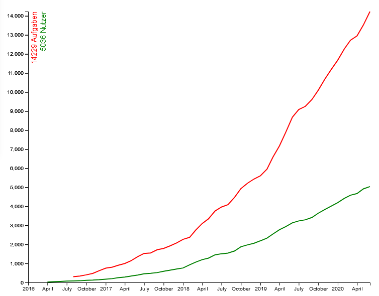
Our community is growing rapidly: One week ago, Lorenzo Salucci, a student teacher from Luxembourg, registered as 5,000th user in our portal. All in all (and despite of Corona), we have already welcomed more than 1,000 new users to MCM this year. Our “anniversary user” Lorenzo Salucci gave us an interview about the MathCityMap system which is presented in the following.
Mr. Salucci, you are a student at a Luxembourg university. How did you get in contact with the MathCityMap project? How is it used in the university?
Exactly, I am a student at the Université du Luxembourg and am studying to become a teacher. I came across the MathCityMap project in our mathematics course “Didactics of Mathematics”. In our course, the project is used as a substitute for exams because of the Covid-19 pandemic. We have to create a math trail in small groups near primary schools in Luxembourg. These are then evaluated by our teachers and fellow students.
Have you already had your first practical experience with MCM? What do you expect or promise from the use of MCM in everyday school life?
Personally, I haven’t had the opportunity to do a trail yet, but I plan to try out a math trail in the next few weeks. I believe that the use of an MCM makes it possible to give the students an understanding of mathematics in the outside world. Many people think that mathematics is only taught very theoretically at school. However, the MCM gives you the opportunity to bring applied and realistic tasks as well as other mathematical riddles into real everyday situations.
You have already created your own tasks. What is it about exactly?
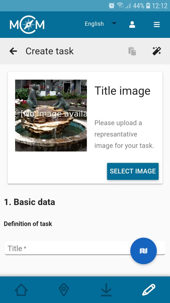
Together with two colleagues we have already created our own trail “Mathematik Trail nahe der Scheierhaff-Schule” (engl.: “Math Trail near Scheierhaff School”; Code: 452734). This trail is located on the property of the primary school “Scheierhaff” in Soleuvre, Luxembourg. One task from this trail is located in the playground of the kindergarten, the object of the task is a raised bed. The mathematical topic of this task is the volume. The students have to calculate the volume of this raised bed. One of our teacher’s demands is that we give the pupils two tips on how to solve the task, so we decided to give the children the formula for the volume (volume = length x width x height) and we gave them the hint that 1 meter corresponds to 100 centimeters.