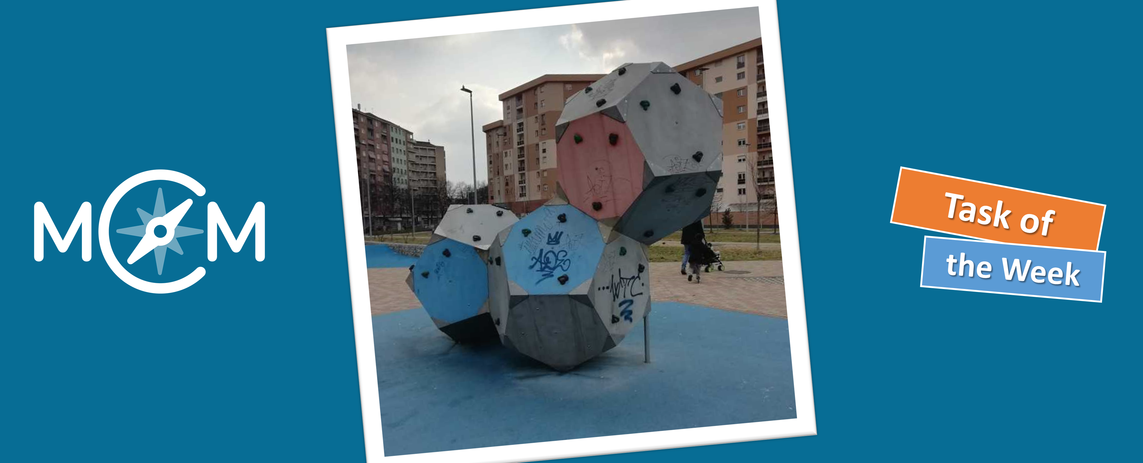
In Turin, Italy, we find our new task of the week. Here the teacher Michela Viale created the task “I blocchi da arrampicata del Parco Mennea” (engl.: “The climbing blocks of the Mennea Park”), in which the visible surface of stapled dodecahedrons should be calculated.
Michela, how did you discover the MathCityMap project?
I got in contact with MCM four years ago, when I was attending a math online course at the university of Torino, Math Department, where I had to create my first MathCityMap task. By participating another MOOC in the spring of 2020, I created my own math trail on MCM.
I am a teacher at middle school (from 11 to 14 years old) and I love to create “real problems” for my students. By using MCM I can organize outdoor mathematical problem solving for my students.
Describe your task. How can it be solved?
My task is placed in a park in Turin (Parco P. P. Mennea). It is a climbing block for children made up of three dodecahedra. Since the blocks are stapled on top of each other, they have some common sides, which are therefore not visible. I ask to children to calculate the area of the visible sides (the surface they could paint). They have to recognize the dodecahedron, count the number of the sides they could paint, calculate the area of one side (which is a regular pentagon).
What didactic goals do you pursue with the task?
I want to stimulate different didactic aims: recognize solids and plane figures around us, measure them, calculate their surface. In general, I think MCM is very useful to improve Math competences. I’ll create a new math trail during my holidays in Sardinia in August.